Delhi records season's wettest day; Najafgarh gets highest rainfall at 84 mm
Heavy rain swept Delhi on Tuesday, sharply cooling the city after sultry conditions. The showers also triggered waterlogging, tree falls and a fresh IMD alert for more storms.
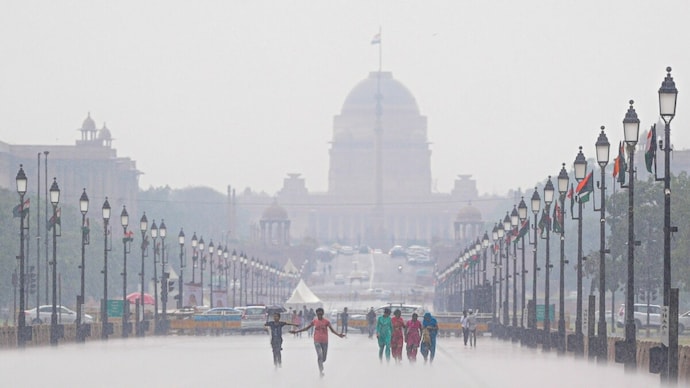
Persistent showers across Delhi on Tuesday brought relief from days of sultry weather, making it the capital's wettest day of the year so far. The rain led to a sharp fall in temperature, but also caused waterlogging, uprooted trees and heavy traffic on several roads.
Parts of the city received nearly 84 mm of rain, while the "feels like" temperature fell by almost 22 degrees Celsius during the day, even as humidity stayed very high. The India Meteorological Department has forecast thunderstorms with rain on Wednesday and issued an alert for the capital.
According to the IMD, Najafgarh recorded the highest rainfall between 8.30 am and 5.30 pm at 84 mm. The Ridge received 50.1 mm, Pusa 41.5 mm, Ayanagar 32.6 mm, Mayur Vihar 19 mm, Palam 15.4 mm, Rajghat 14.6 mm, Lodi Road 13.2 mm and Safdarjung 11.9 mm.
Safdarjung saw the steepest temperature drop of 10 degrees Celsius between 1 pm and 2.30 pm. Chhatarpur recorded a fall of 9.1 degrees, followed by Najafgarh at 8.9 degrees, Janakpuri 8.7 degrees, Jafarpur 8.6 degrees, Narayana 8.4 degrees, Palam and Pusa 8 degrees each, Pitampura 7.6 degrees, Mayur Vihar 7.3 degrees and Pragati Maidan 6.7 degrees.
Traffic jams were reported on Geeta Colony Road towards Noida, NH-48, Old Rohtak Road and Akshardham Road towards Noida. Waterlogging was reported from several areas, including Mahavir Bazar in Teliwara, Geeta Colony, near Tis Hazari Court, Sangam Vihar, Wazirabad, Jagatpur and the Badarpur border.
In East of Kailash, a large tree was uprooted in the rain and fell on a parked Mercedes and another passing vehicle. Between 2 pm and 6 pm, the New Delhi Municipal Council received two complaints each of waterlogging and tree falls.
The Municipal Corporation of Delhi recorded four complaints of uprooted trees in the West Zone and also received two complaints about dangerous buildings, from Tagore Garden and Jagatpuri.
Mahesh Palawat of Skymet said the continuous rain over Delhi was caused by the interaction of a western disturbance over northern Pakistan, an intense low-pressure area over central Madhya Pradesh and moisture-laden monsoon winds from the Arabian Sea.
He said the intensity of rain would gradually decrease over the next two days as temperatures rise slightly, with only isolated spells likely in Delhi. Palawat said the seasonal trough is now over central India and is expected to shift northwards around July 12 and settle along the Himalayan foothills after passing through Delhi.
"Delhi, Haryana, Rajasthan and adjoining northwestern parts are likely to experience a break monsoon phase with comparatively dry weather from that time," he said.
IMD data showed that the "feels like" temperature rose from 44.7 degrees Celsius at 8.30 am to 47.5 degrees Celsius at 11.30 am, before falling to 32.3 degrees Celsius at 2.30 pm and then to 25.6 degrees Celsius by 5.30 pm after thunderstorm activity.
Humidity was 79 per cent at 8.30 am, dropped to 60 per cent by 11.30 am, and then rose to 100 per cent at 2.30 pm and stayed there at 5.30 pm after widespread rain.
The strongest winds were recorded at Palam and Pusa at 41 kmph, followed by Jafarpur at 39 kmph, Pragati Maidan at 35 kmph, Mayur Vihar at 33 kmph, Narayana and Chhatarpur at 31 kmph each, and Safdarjung at 19 kmph.
The maximum temperature settled at 37.2 degrees Celsius at Safdarjung, 0.6 notches above normal. Palam recorded 37.6 degrees Celsius, 0.2 notches above normal, while Lodi Road registered 37 degrees Celsius, two notches above normal. The Ridge recorded 36.1 degrees Celsius, 0.1 notch below normal, and Ayanagar logged 36.3 degrees Celsius, 0.3 notch below normal.
The minimum temperature settled at 30 degrees Celsius at Safdarjung, 2.1 notches above normal. Palam recorded 28.3 degrees Celsius, 0.1 notch above normal, Lodi Road 30.4 degrees Celsius, 3.4 notches above normal, the Ridge 24.9 degrees Celsius, 1.5 notches below normal, and Ayanagar 28.6 degrees Celsius, 1.9 notches above normal. The minimum temperature was the highest recorded in July since July 2, 2024, when the city had logged 30.7 degrees Celsius.
The IMD has forecast a minimum temperature of around 26 degrees Celsius and a maximum of around 33 degrees Celsius on Wednesday. Despite the widespread showers, Delhi's air quality remained in the "moderate" category, with the Central Pollution Control Board recording an AQI of 113.
The CPCB classifies an AQI of 101 to 200 as "moderate". Overall, Tuesday's rain brought a marked drop in temperatures across Delhi, while also disrupting traffic and civic conditions in several parts of the city.
Persistent showers across Delhi on Tuesday brought relief from days of sultry weather, making it the capital's wettest day of the year so far. The rain led to a sharp fall in temperature, but also caused waterlogging, uprooted trees and heavy traffic on several roads.
Parts of the city received nearly 84 mm of rain, while the "feels like" temperature fell by almost 22 degrees Celsius during the day, even as humidity stayed very high. The India Meteorological Department has forecast thunderstorms with rain on Wednesday and issued an alert for the capital.
According to the IMD, Najafgarh recorded the highest rainfall between 8.30 am and 5.30 pm at 84 mm. The Ridge received 50.1 mm, Pusa 41.5 mm, Ayanagar 32.6 mm, Mayur Vihar 19 mm, Palam 15.4 mm, Rajghat 14.6 mm, Lodi Road 13.2 mm and Safdarjung 11.9 mm.
Safdarjung saw the steepest temperature drop of 10 degrees Celsius between 1 pm and 2.30 pm. Chhatarpur recorded a fall of 9.1 degrees, followed by Najafgarh at 8.9 degrees, Janakpuri 8.7 degrees, Jafarpur 8.6 degrees, Narayana 8.4 degrees, Palam and Pusa 8 degrees each, Pitampura 7.6 degrees, Mayur Vihar 7.3 degrees and Pragati Maidan 6.7 degrees.
Traffic jams were reported on Geeta Colony Road towards Noida, NH-48, Old Rohtak Road and Akshardham Road towards Noida. Waterlogging was reported from several areas, including Mahavir Bazar in Teliwara, Geeta Colony, near Tis Hazari Court, Sangam Vihar, Wazirabad, Jagatpur and the Badarpur border.
In East of Kailash, a large tree was uprooted in the rain and fell on a parked Mercedes and another passing vehicle. Between 2 pm and 6 pm, the New Delhi Municipal Council received two complaints each of waterlogging and tree falls.
The Municipal Corporation of Delhi recorded four complaints of uprooted trees in the West Zone and also received two complaints about dangerous buildings, from Tagore Garden and Jagatpuri.
Mahesh Palawat of Skymet said the continuous rain over Delhi was caused by the interaction of a western disturbance over northern Pakistan, an intense low-pressure area over central Madhya Pradesh and moisture-laden monsoon winds from the Arabian Sea.
He said the intensity of rain would gradually decrease over the next two days as temperatures rise slightly, with only isolated spells likely in Delhi. Palawat said the seasonal trough is now over central India and is expected to shift northwards around July 12 and settle along the Himalayan foothills after passing through Delhi.
"Delhi, Haryana, Rajasthan and adjoining northwestern parts are likely to experience a break monsoon phase with comparatively dry weather from that time," he said.
IMD data showed that the "feels like" temperature rose from 44.7 degrees Celsius at 8.30 am to 47.5 degrees Celsius at 11.30 am, before falling to 32.3 degrees Celsius at 2.30 pm and then to 25.6 degrees Celsius by 5.30 pm after thunderstorm activity.
Humidity was 79 per cent at 8.30 am, dropped to 60 per cent by 11.30 am, and then rose to 100 per cent at 2.30 pm and stayed there at 5.30 pm after widespread rain.
The strongest winds were recorded at Palam and Pusa at 41 kmph, followed by Jafarpur at 39 kmph, Pragati Maidan at 35 kmph, Mayur Vihar at 33 kmph, Narayana and Chhatarpur at 31 kmph each, and Safdarjung at 19 kmph.
The maximum temperature settled at 37.2 degrees Celsius at Safdarjung, 0.6 notches above normal. Palam recorded 37.6 degrees Celsius, 0.2 notches above normal, while Lodi Road registered 37 degrees Celsius, two notches above normal. The Ridge recorded 36.1 degrees Celsius, 0.1 notch below normal, and Ayanagar logged 36.3 degrees Celsius, 0.3 notch below normal.
The minimum temperature settled at 30 degrees Celsius at Safdarjung, 2.1 notches above normal. Palam recorded 28.3 degrees Celsius, 0.1 notch above normal, Lodi Road 30.4 degrees Celsius, 3.4 notches above normal, the Ridge 24.9 degrees Celsius, 1.5 notches below normal, and Ayanagar 28.6 degrees Celsius, 1.9 notches above normal. The minimum temperature was the highest recorded in July since July 2, 2024, when the city had logged 30.7 degrees Celsius.
The IMD has forecast a minimum temperature of around 26 degrees Celsius and a maximum of around 33 degrees Celsius on Wednesday. Despite the widespread showers, Delhi's air quality remained in the "moderate" category, with the Central Pollution Control Board recording an AQI of 113.
The CPCB classifies an AQI of 101 to 200 as "moderate". Overall, Tuesday's rain brought a marked drop in temperatures across Delhi, while also disrupting traffic and civic conditions in several parts of the city.

