The map war: Why India is naming places in Arunachal Pradesh, and China is upset
New Delhi standardising names of 27 locations in Arunachal Pradesh is the newest chapter in a long-running territorial contest with Beijing
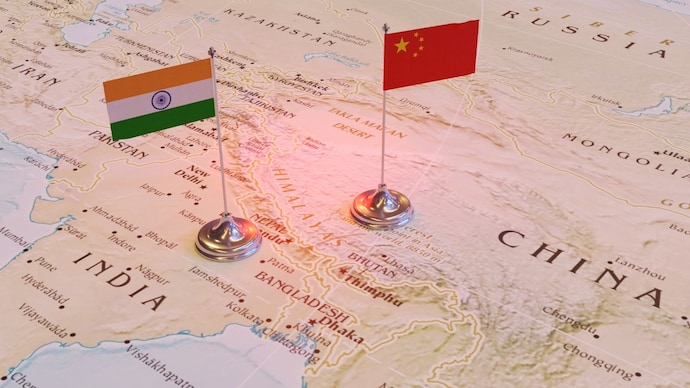
India’s response has been equally clear. The ministry of external affairs (MEA), on August 11, reiterated that Arunachal Pradesh is an “inalienable and integral” part of India and that attempts to alter the nomenclature cannot change that reality. The ministry made it clear that maintenance of peace and tranquillity in these areas was of utmost importance, adding that the state of the border affairs would reflect on the state of wider bilateral ties.
The latest exchange is the newest chapter in a long-running contest over maps, names and territory between India and China. For New Delhi, the logic is straightforward: India is not naming foreign territory. It is standardising the names of places in a state that it administers and considers an integral part of the country. For Beijing, however, the move is another attempt by India to strengthen its claim over territory that China says belongs to it.
Military observers believe this is a tit-for-tat response to China’s practice of attempting to bolster territorial claims by renaming Indian territory and subsequently issuing official or legal documents to reinforce those claims. Such cartographic and administrative measures are part of a well-established Chinese standard operating procedure.
Sriparna Pathak, professor, China studies, OP Jindal Global University, maintained that India’s formal naming of 27 locations in Arunachal Pradesh on official Survey of India maps is a decisive assertion of sovereignty that directly counters Beijing’s repeated cartographic aggression and attempts to invent Chinese names for Indian territory. She said this move reinforces the undeniable reality that Arunachal Pradesh is an integral and inalienable part of India, rooted in the McMahon Line established at the 1914 Simla Convention between British India and Tibet.
“Sites such as Longju—scene of the 1959 Chinese intrusion—and Thag La—where major battles erupted in the 1962 India-China war—carry deep historical significance as markers of India’s defence of its frontiers against expansionism. Memorials like Jaswant Garh and the Sher-e-Thapa Memorial further honour the sacrifices of Indian soldiers who stood firm in those conflicts, embedding national memory into the official map,” said Pathak. She added that China’s so-called “map war” through fictitious renaming was a clear attempt to manufacture claims over land it never controlled and that this cannot alter the ground reality of Indian sovereignty.
Experts pointed out that by standardising these names in consultation with the Arunachal Pradesh government, India had strengthened public awareness, administrative clarity and strategic resolve along the Line of Actual Control (LAC). This firm response upholds India’s territorial integrity and signals that no amount of Chinese propaganda will ever change the fact of Arunachal’s permanent place within the Indian Union.
Major General A.P. Singh (retd), who served extensively with the Indian Army's Leh-based XIV Corps, believes cartographic salami-slicing is a form of Chinese aggression and appears to be part of a broader strategy to physically occupy tactically advantageous positions in Arunachal Pradesh and East Sikkim, including the Jampheri Ridge (located on the contentious Doklam Plateau).
“Indian planners have now initiated a tit-for-tat response by naming these 27 locations. We must also aggressively develop and settle forward areas—not merely to reinforce our claims but to also create durable bases for our patrols and other activities,” Maj. Gen. Singh said.
The dispute over names is not new. China began its current series of naming exercises in Arunachal Pradesh in 2017 when it announced Chinese names for six locations. It followed these with further lists in 2021, 2023, 2024 and 2025. In April 2024, Beijing announced names for 30 more locations. India rejected each exercise, saying that changing the names of places could not alter their status.
The latest Indian move is therefore best understood as a direct pushback. Beijing has been using its own nomenclature to reinforce its territorial narrative; New Delhi is making sure its official maps reflect the names recognised by India. That may sound symbolic, but symbolism carries weight in a territorial dispute.
Maps are used by governments, militaries, international organisations and researchers. Repeatedly using a particular name can gradually influence how a place is perceived. Neither India nor China wants the other's terminology to become accepted as the default.
Nowadays, the frontier looks very different. India has accelerated the construction of roads, bridges and other infrastructure to improve access to forward areas while China has undertaken extensive infrastructure development on its side of the border. In the Himalayas, the ability to move troops, equipment and supplies quickly can be as important as the size of the forces deployed. That makes the latest naming exercise part of a larger contest over how the frontier is represented and controlled.
China's response follows a familiar pattern. Beijing maintains that Arunachal Pradesh is part of southern Tibet and objects whenever India carries out administrative or political activity there New Delhi considers an assertion of Indian sovereignty. Chinese state-linked media has also argued that India's naming exercise could complicate efforts to improve bilateral relations and resolve the boundary dispute.
India has repeatedly rejected that argument. When China released its 30-name list in 2024, MEA spokesperson Randhir Jaiswal dismissed the move and said that assigning “invented” names could not change the reality that Arunachal Pradesh was an integral and inalienable part of India. External affairs minister S. Jaishankar has made the same point in even simpler terms: changing the name of a place does not change its ownership.
The timing of the latest exchange is significant. India and China have spent the past few years trying to stabilise relations after military crisis along the LAC, particularly the deadly Galwan clash in eastern Ladakh in 2020. The two sides have since taken steps to ease tensions at several friction points and restore some normalcy to diplomatic ties.
But Arunachal Pradesh remains one of the most difficult parts of the relationship. China's claim covers the entire state. That makes every Indian move there—whether political, administrative or infrastructural—particularly sensitive for Beijing.
For New Delhi, the challenge is to remain firm on its territorial position without allowing every Chinese action to trigger a wider escalation. The latest response reflects that balance: India has rejected China's objection outright while maintaining that the border issue has a direct bearing on the broader bilateral relationship.
Military analysts maintained that 27 names are only one element of a much bigger competition. What matters on the ground is not simply what a mountain, pass or lake is called, but who administers it, who can reach it and who can maintain a sustained presence there. India's investment in border roads, bridges, communications and military infrastructure is therefore far more consequential than the wording on a map. China is pursuing its own infrastructure push across the frontier.
Yet maps matter because they put territorial claims into a form that is visible, official and repeatable. China can continue to use its own names for places in Arunachal Pradesh. India will continue to use its own official nomenclature and reject Beijing's claims. Neither side is likely to change its position because of a name. But that is precisely why the latest exchange matters. The India-China border dispute is no longer being fought only on the ground or across negotiating tables. It is also being fought on maps—and over names printed on them.
Subscribe to India Today Magazine
India’s response has been equally clear. The ministry of external affairs (MEA), on August 11, reiterated that Arunachal Pradesh is an “inalienable and integral” part of India and that attempts to alter the nomenclature cannot change that reality. The ministry made it clear that maintenance of peace and tranquillity in these areas was of utmost importance, adding that the state of the border affairs would reflect on the state of wider bilateral ties.
The latest exchange is the newest chapter in a long-running contest over maps, names and territory between India and China. For New Delhi, the logic is straightforward: India is not naming foreign territory. It is standardising the names of places in a state that it administers and considers an integral part of the country. For Beijing, however, the move is another attempt by India to strengthen its claim over territory that China says belongs to it.
Military observers believe this is a tit-for-tat response to China’s practice of attempting to bolster territorial claims by renaming Indian territory and subsequently issuing official or legal documents to reinforce those claims. Such cartographic and administrative measures are part of a well-established Chinese standard operating procedure.
Sriparna Pathak, professor, China studies, OP Jindal Global University, maintained that India’s formal naming of 27 locations in Arunachal Pradesh on official Survey of India maps is a decisive assertion of sovereignty that directly counters Beijing’s repeated cartographic aggression and attempts to invent Chinese names for Indian territory. She said this move reinforces the undeniable reality that Arunachal Pradesh is an integral and inalienable part of India, rooted in the McMahon Line established at the 1914 Simla Convention between British India and Tibet.
“Sites such as Longju—scene of the 1959 Chinese intrusion—and Thag La—where major battles erupted in the 1962 India-China war—carry deep historical significance as markers of India’s defence of its frontiers against expansionism. Memorials like Jaswant Garh and the Sher-e-Thapa Memorial further honour the sacrifices of Indian soldiers who stood firm in those conflicts, embedding national memory into the official map,” said Pathak. She added that China’s so-called “map war” through fictitious renaming was a clear attempt to manufacture claims over land it never controlled and that this cannot alter the ground reality of Indian sovereignty.
Experts pointed out that by standardising these names in consultation with the Arunachal Pradesh government, India had strengthened public awareness, administrative clarity and strategic resolve along the Line of Actual Control (LAC). This firm response upholds India’s territorial integrity and signals that no amount of Chinese propaganda will ever change the fact of Arunachal’s permanent place within the Indian Union.
Major General A.P. Singh (retd), who served extensively with the Indian Army's Leh-based XIV Corps, believes cartographic salami-slicing is a form of Chinese aggression and appears to be part of a broader strategy to physically occupy tactically advantageous positions in Arunachal Pradesh and East Sikkim, including the Jampheri Ridge (located on the contentious Doklam Plateau).
“Indian planners have now initiated a tit-for-tat response by naming these 27 locations. We must also aggressively develop and settle forward areas—not merely to reinforce our claims but to also create durable bases for our patrols and other activities,” Maj. Gen. Singh said.
The dispute over names is not new. China began its current series of naming exercises in Arunachal Pradesh in 2017 when it announced Chinese names for six locations. It followed these with further lists in 2021, 2023, 2024 and 2025. In April 2024, Beijing announced names for 30 more locations. India rejected each exercise, saying that changing the names of places could not alter their status.
The latest Indian move is therefore best understood as a direct pushback. Beijing has been using its own nomenclature to reinforce its territorial narrative; New Delhi is making sure its official maps reflect the names recognised by India. That may sound symbolic, but symbolism carries weight in a territorial dispute.
Maps are used by governments, militaries, international organisations and researchers. Repeatedly using a particular name can gradually influence how a place is perceived. Neither India nor China wants the other's terminology to become accepted as the default.
Nowadays, the frontier looks very different. India has accelerated the construction of roads, bridges and other infrastructure to improve access to forward areas while China has undertaken extensive infrastructure development on its side of the border. In the Himalayas, the ability to move troops, equipment and supplies quickly can be as important as the size of the forces deployed. That makes the latest naming exercise part of a larger contest over how the frontier is represented and controlled.
China's response follows a familiar pattern. Beijing maintains that Arunachal Pradesh is part of southern Tibet and objects whenever India carries out administrative or political activity there New Delhi considers an assertion of Indian sovereignty. Chinese state-linked media has also argued that India's naming exercise could complicate efforts to improve bilateral relations and resolve the boundary dispute.
India has repeatedly rejected that argument. When China released its 30-name list in 2024, MEA spokesperson Randhir Jaiswal dismissed the move and said that assigning “invented” names could not change the reality that Arunachal Pradesh was an integral and inalienable part of India. External affairs minister S. Jaishankar has made the same point in even simpler terms: changing the name of a place does not change its ownership.
The timing of the latest exchange is significant. India and China have spent the past few years trying to stabilise relations after military crisis along the LAC, particularly the deadly Galwan clash in eastern Ladakh in 2020. The two sides have since taken steps to ease tensions at several friction points and restore some normalcy to diplomatic ties.
But Arunachal Pradesh remains one of the most difficult parts of the relationship. China's claim covers the entire state. That makes every Indian move there—whether political, administrative or infrastructural—particularly sensitive for Beijing.
For New Delhi, the challenge is to remain firm on its territorial position without allowing every Chinese action to trigger a wider escalation. The latest response reflects that balance: India has rejected China's objection outright while maintaining that the border issue has a direct bearing on the broader bilateral relationship.
Military analysts maintained that 27 names are only one element of a much bigger competition. What matters on the ground is not simply what a mountain, pass or lake is called, but who administers it, who can reach it and who can maintain a sustained presence there. India's investment in border roads, bridges, communications and military infrastructure is therefore far more consequential than the wording on a map. China is pursuing its own infrastructure push across the frontier.
Yet maps matter because they put territorial claims into a form that is visible, official and repeatable. China can continue to use its own names for places in Arunachal Pradesh. India will continue to use its own official nomenclature and reject Beijing's claims. Neither side is likely to change its position because of a name. But that is precisely why the latest exchange matters. The India-China border dispute is no longer being fought only on the ground or across negotiating tables. It is also being fought on maps—and over names printed on them.
Subscribe to India Today Magazine
India’s response has been equally clear. The ministry of external affairs (MEA), on August 11, reiterated that Arunachal Pradesh is an “inalienable and integral” part of India and that attempts to alter the nomenclature cannot change that reality. The ministry made it clear that maintenance of peace and tranquillity in these areas was of utmost importance, adding that the state of the border affairs would reflect on the state of wider bilateral ties.
The latest exchange is the newest chapter in a long-running contest over maps, names and territory between India and China. For New Delhi, the logic is straightforward: India is not naming foreign territory. It is standardising the names of places in a state that it administers and considers an integral part of the country. For Beijing, however, the move is another attempt by India to strengthen its claim over territory that China says belongs to it.
Military observers believe this is a tit-for-tat response to China’s practice of attempting to bolster territorial claims by renaming Indian territory and subsequently issuing official or legal documents to reinforce those claims. Such cartographic and administrative measures are part of a well-established Chinese standard operating procedure.
Sriparna Pathak, professor, China studies, OP Jindal Global University, maintained that India’s formal naming of 27 locations in Arunachal Pradesh on official Survey of India maps is a decisive assertion of sovereignty that directly counters Beijing’s repeated cartographic aggression and attempts to invent Chinese names for Indian territory. She said this move reinforces the undeniable reality that Arunachal Pradesh is an integral and inalienable part of India, rooted in the McMahon Line established at the 1914 Simla Convention between British India and Tibet.
“Sites such as Longju—scene of the 1959 Chinese intrusion—and Thag La—where major battles erupted in the 1962 India-China war—carry deep historical significance as markers of India’s defence of its frontiers against expansionism. Memorials like Jaswant Garh and the Sher-e-Thapa Memorial further honour the sacrifices of Indian soldiers who stood firm in those conflicts, embedding national memory into the official map,” said Pathak. She added that China’s so-called “map war” through fictitious renaming was a clear attempt to manufacture claims over land it never controlled and that this cannot alter the ground reality of Indian sovereignty.
Experts pointed out that by standardising these names in consultation with the Arunachal Pradesh government, India had strengthened public awareness, administrative clarity and strategic resolve along the Line of Actual Control (LAC). This firm response upholds India’s territorial integrity and signals that no amount of Chinese propaganda will ever change the fact of Arunachal’s permanent place within the Indian Union.
Major General A.P. Singh (retd), who served extensively with the Indian Army's Leh-based XIV Corps, believes cartographic salami-slicing is a form of Chinese aggression and appears to be part of a broader strategy to physically occupy tactically advantageous positions in Arunachal Pradesh and East Sikkim, including the Jampheri Ridge (located on the contentious Doklam Plateau).
“Indian planners have now initiated a tit-for-tat response by naming these 27 locations. We must also aggressively develop and settle forward areas—not merely to reinforce our claims but to also create durable bases for our patrols and other activities,” Maj. Gen. Singh said.
The dispute over names is not new. China began its current series of naming exercises in Arunachal Pradesh in 2017 when it announced Chinese names for six locations. It followed these with further lists in 2021, 2023, 2024 and 2025. In April 2024, Beijing announced names for 30 more locations. India rejected each exercise, saying that changing the names of places could not alter their status.
The latest Indian move is therefore best understood as a direct pushback. Beijing has been using its own nomenclature to reinforce its territorial narrative; New Delhi is making sure its official maps reflect the names recognised by India. That may sound symbolic, but symbolism carries weight in a territorial dispute.
Maps are used by governments, militaries, international organisations and researchers. Repeatedly using a particular name can gradually influence how a place is perceived. Neither India nor China wants the other's terminology to become accepted as the default.
Nowadays, the frontier looks very different. India has accelerated the construction of roads, bridges and other infrastructure to improve access to forward areas while China has undertaken extensive infrastructure development on its side of the border. In the Himalayas, the ability to move troops, equipment and supplies quickly can be as important as the size of the forces deployed. That makes the latest naming exercise part of a larger contest over how the frontier is represented and controlled.
China's response follows a familiar pattern. Beijing maintains that Arunachal Pradesh is part of southern Tibet and objects whenever India carries out administrative or political activity there New Delhi considers an assertion of Indian sovereignty. Chinese state-linked media has also argued that India's naming exercise could complicate efforts to improve bilateral relations and resolve the boundary dispute.
India has repeatedly rejected that argument. When China released its 30-name list in 2024, MEA spokesperson Randhir Jaiswal dismissed the move and said that assigning “invented” names could not change the reality that Arunachal Pradesh was an integral and inalienable part of India. External affairs minister S. Jaishankar has made the same point in even simpler terms: changing the name of a place does not change its ownership.
The timing of the latest exchange is significant. India and China have spent the past few years trying to stabilise relations after military crisis along the LAC, particularly the deadly Galwan clash in eastern Ladakh in 2020. The two sides have since taken steps to ease tensions at several friction points and restore some normalcy to diplomatic ties.
But Arunachal Pradesh remains one of the most difficult parts of the relationship. China's claim covers the entire state. That makes every Indian move there—whether political, administrative or infrastructural—particularly sensitive for Beijing.
For New Delhi, the challenge is to remain firm on its territorial position without allowing every Chinese action to trigger a wider escalation. The latest response reflects that balance: India has rejected China's objection outright while maintaining that the border issue has a direct bearing on the broader bilateral relationship.
Military analysts maintained that 27 names are only one element of a much bigger competition. What matters on the ground is not simply what a mountain, pass or lake is called, but who administers it, who can reach it and who can maintain a sustained presence there. India's investment in border roads, bridges, communications and military infrastructure is therefore far more consequential than the wording on a map. China is pursuing its own infrastructure push across the frontier.
Yet maps matter because they put territorial claims into a form that is visible, official and repeatable. China can continue to use its own names for places in Arunachal Pradesh. India will continue to use its own official nomenclature and reject Beijing's claims. Neither side is likely to change its position because of a name. But that is precisely why the latest exchange matters. The India-China border dispute is no longer being fought only on the ground or across negotiating tables. It is also being fought on maps—and over names printed on them.
Subscribe to India Today Magazine

