Delhi's rare July monsoon: Western disturbances crash El Nino's weakening party
The southwest monsoon reached Delhi on July 2, five days late and for the first time in July since 2021, as El Nino slowed its northward march. A rare summer western disturbance then teamed up with the monsoon trough to finally bring the rain.
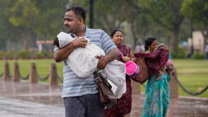
For most of June, Delhi looked up at a sky that refused to break. The heat crossed 42 degrees Celsius, the air turned sticky, and the rain simply did not come. Then, on July 2, it did.
The southwest monsoon officially arrived in the national capital, five days after its normal onset date of June 27. This is the first time since 2021 that the monsoon has reached Delhi in July.
The delay was no accident. And neither was the arrival. Two giant weather systems, one born in the Pacific Ocean and the other near the Mediterranean Sea, fought over Delhi's skies. The Mediterranean won this round.
WHY IS THE MONSOON LATE IN DELHI THIS YEAR?
The short answer is El Nino. This is the periodic warming of the surface waters of the central and eastern Pacific Ocean, thousands of kilometres from India.
That distant warmth matters because it shifts the engine of the monsoon. Rising moist air, which normally sits over the Indian Ocean region and fuels our rains, drifts eastwards over the Pacific. What India gets instead is sinking, dry air that suppresses clouds and rainfall.
The India Meteorological Department (IMD) has said El Nino conditions are expected to strengthen through the season, and has forecast below normal rainfall for the country, at around 90 per cent of the long-period average.
The damage is already visible. June 2026 turned out to be the fifth-driest June since 1901, with rainfall 39 per cent below normal across India. Delhi's Safdarjung observatory recorded just 41.8 mm against its June normal of 74.1 mm.
WHAT IS A WESTERN DISTURBANCE?
A western disturbance is a storm system that forms over the Mediterranean, Black Sea and Caspian Sea regions and travels eastwards towards India, carried by a river of fast-moving air high in the atmosphere called the subtropical jet stream.
These systems are winter visitors. Between December and February, they bring rain to the plains of northwest India and snow to the Himalayas. In the monsoon months, they are rare guests. This year, they kept showing up.
HOW DID A WESTERN DISTURBANCE BRING THE MONSOON TO DELHI?
In the final days of June, a western disturbance parked itself over the western Himalayan region just as the monsoon trough, an elongated belt of low pressure that pulls moist winds inland from the Arabian Sea and the Bay of Bengal, stretched from Rajasthan to the Bay of Bengal.
When the two systems interact, the atmosphere becomes deeply unstable. Air is forced to rise, moisture converges from both directions, and rain follows. The IMD said this combined influence, along with a low pressure area over the Bay of Bengal, powered the monsoon's march into Delhi, Haryana and Punjab.
In other words, even as El Nino weakened the monsoon from afar, a mid-latitude intruder locally overpowered it.
WHEN WILL IT RAIN IN DELHI NEXT?
The IMD has forecast cloudy skies with light to moderate rain over Delhi through July 8, with rainfall expected to intensify from July 5. Maximum temperatures should stay between 32 and 36 degrees Celsius.
The larger season, however, remains under El Nino's shadow. Expect a monsoon of contradictions: bursts of heavy rain in some pockets, stubborn deficits elsewhere.