Delhi, Punjab brace for storms on Thursday, Assam to face hot and humid spell
Delhi will see cloudy skies, rain and two spells of thunderstorms with gusty winds this Thursday as the monsoon advances further north. The IMD has also flagged extremely heavy rainfall risk in Gujarat, Konkan, Karnataka and Madhya Pradesh this week.
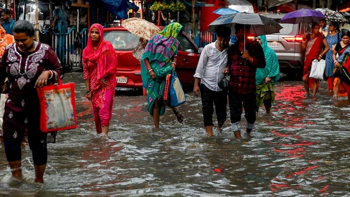
Delhi is set for another spell of cloudy skies, rain and thunderstorms this Thursday, July 2, as the southwest monsoon continues its steady push across north India, the India Meteorological Department (IMD) said.
According to IMD's Delhi-NCR forecast, the sky will remain generally cloudy through the day. Light rain is expected at many places, with moderate rain at a few isolated pockets.
Two spells of thunderstorms, accompanied by lightning and gusty winds of 40 to 50 kmph, gusting up to 60 kmph, are likely, one towards the morning and forenoon, and another towards the evening and night.
The maximum temperature is expected to settle between 32 and 34 degrees Celsius, while the minimum will hover between 22 and 24 degrees Celsius, a welcome dip from the heat of recent weeks. Winds will blow from the northwest in the morning, shifting to the west by afternoon and the northeast by night.
The IMD has cautioned that the gusty winds could snap tree branches, disrupt power and communication lines, and cause minor damage to weak structures. Residents have been advised to stay indoors during active thunderstorm spells, avoid sheltering under trees, and unplug electrical appliances until conditions ease.
WHY IS THE MONSOON MOVING SO SLOW OVER NORTH INDIA?
A monsoon is simply the seasonal wind pattern that carries moisture-laden air from the sea to the land, bringing India's annual rains.
Its northern limit, the line marking how far it has travelled, passed through Porbandar, Meerut, Karnal and Gurdaspur by July 1.
The IMD said conditions are favourable for it to advance further into parts of Gujarat, Madhya Pradesh, Uttar Pradesh, Haryana, Chandigarh, Delhi, Punjab and Rajasthan over the following two days.
Meteorologists also flagged an upper air cyclonic circulation, essentially a pocket of swirling wind, hovering over Punjab, which is helping pull moisture towards the capital.
Meanwhile, in the northeast, Assam and Meghalaya are set for a spell of hot and humid weather between July 2 and 5, IMD said, even as scattered to fairly widespread rain continues over the region.
Isolated thunderstorms and lightning are also likely there through July 5, so the humidity is expected to persist rather than break.
WHICH STATES SHOULD WATCH OUT FOR HEAVY RAIN THIS WEEK?
A low pressure area, a zone of reduced atmospheric pressure that often intensifies rainfall, is likely to form over the northwest Bay of Bengal around July 3.
This is expected to keep the monsoon active over central India for the next five to six days.
The IMD has flagged isolated extremely heavy rainfall, meaning over 20 centimetres in a day, over south Gujarat and Konkan between July 1 and 5, coastal Karnataka on July 1 and 2, Madhya Maharashtra between July 2 and 5, and southwest Madhya Pradesh on July 3 and 4.
Officials have urged commuters to check traffic conditions before travelling, avoid waterlogging-prone stretches, and stay away from vulnerable buildings during the storm spells.
Farmers in rain-hit states have been advised to drain excess water from nursery beds and vegetable fields to prevent crop damage.
With the monsoon now firmly astride the Indo-Gangetic plain, Delhi's brief spell of pre-monsoon heat looks set to give way to a longer stretch of grey skies and intermittent showers through the coming week.