Mega tsunami six times the size of Qutub Minar hit Alaska. No one knew it happened
Scientists reconstructed a 481-metre tsunami that struck Alaska's Tracy Arm Fjord after a huge landslide. The near-miss event highlights how glacier retreat can destabilise slopes and trigger extreme waves.
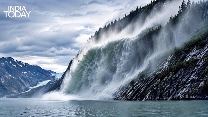
A gigantic tsunami six times the height of India's Qutub Minar slammed into a remote Alaskan fjord in 2025, but remarkably, almost no one witnessed it in real time.
Scientists have now reconstructed the event in stunning detail, revealing that the 481-metre-high “mega tsunami” was one of the largest ever recorded on Earth. The height of Qutub Minar in New Delhi is 72.5 metres.
The massive wave struck Tracy Arm Fjord in southeastern Alaska on August 10, 2025, after a colossal landslide sent more than 64 million cubic metres of rock crashing into the narrow glacial inlet.
The impact displaced huge amounts of water almost instantly, unleashing an enormous wave that raced through the fjord at speeds exceeding 250 kilometres per hour.
Researchers say the tsunami reached a maximum run-up height of 1,578 feet (481 metres), making it the second-highest tsunami ever documented after Alaska’s famous 1958 Lituya Bay megatsunami.
What makes the event extraordinary is that almost nobody saw it happen.
The tsunami occurred at around 5:30 am local time in a remote fjord frequented mainly by cruise ships and kayakers. Because it happened before tourist vessels entered the area, no deaths or injuries were reported. Scientists later described it as a “near miss” disaster that could have turned catastrophic had it occurred just a few hours later.
So how did scientists detect a tsunami no one heard or saw?
According to the study published in the journal Science, researchers pieced together the event using satellite imagery, aerial surveys, seismic recordings and computer simulations.
The landslide itself generated long-period seismic waves powerful enough to be detected around the world. Scientists said the seismic signal was equivalent to a magnitude 5.4 earthquake.
Even more unusual was what happened afterwards. The tsunami created a seiche, a standing wave trapped inside the fjord that caused water to slosh back and forth for more than 24 hours. This generated a persistent seismic vibration with a roughly 66-second rhythm that continued globally for up to 36 hours.
Satellite images later revealed massive scars along the fjord walls where forests and vegetation had been stripped away by the towering wave.
Researchers linked the landslide to climate change-driven glacier retreat. As the South Sawyer Glacier rapidly melted and retreated, it destabilised the steep mountain slope above the fjord, eventually triggering the collapse.
Scientists warn that such climate-linked megatsunamis could become more common in glacier regions as warming temperatures continue reshaping fragile mountain landscapes.