Mumbai rain: Monsoon showers arrive after being held hostage. There's science behind
Mumbai woke up on June 21 to passing showers across its suburbs, breaking weeks of an unusual dry spell that had pushed the city's reservoirs to critically low levels. The IMD has issued a yellow alert for June 22 and 23, with heavier rainfall expected around June 25 and 26 as the monsoon strengthens further.
Mumbai's monsoon had not gone anywhere. It had simply been held hostage.
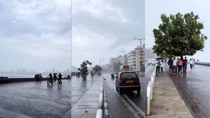
The city woke up on June 21 to passing showers rolling across its suburbs, the first proper rain of the season after an unusually long and punishing dry spell.
Ghatkopar recorded roughly 24 mm, Worli around 25 mm, Lower Parel 21 mm, and Chembur 20 mm, all in the early morning hours. In Thane, people stepped outside just to smell the petrichor, that sharp, earthy scent that wet soil releases after a long dry period.
The India Meteorological Department has issued a yellow alert for June 22 and 23, warning of thunderstorms, lightning, and gusty winds reaching 30 to 40 kmph at isolated places. Conditions are also favourable for the southwest monsoon to advance further into Maharashtra around June 23.
Independent weather observers, tracking the sky above the city on Saturday evening, all noticed the same quiet rearrangement happening overhead.
Rainbands were developing over the Mumbai Metropolitan Region.
Pop-up storm cells were forming over the Western Ghats and tracking toward the coast.
The dry air that had been sitting over the city like a lid, holding everything back, was finally weakening.
That lid is the story.
WHAT IS DRY AIR DOING TO MUMBAI?
The southwest monsoon arrived over Mumbai weeks ago. The moisture from the Arabian Sea is out there. So why did it take so long?
The answer lies in a process called entrainment.
Mumbai's reservoirs had dropped to roughly 9 to 10 per cent capacity by mid-June. The city recorded a rainfall deficit of over 90 per cent in some areas, with the Colaba weather station recording only about 4.3 mm for the early part of June.
The clouds that bring Mumbai its rain are tall convective columns called cumulonimbus. These clouds grow when warm, moist air rises rapidly from the surface, cools as it climbs, and condenses into water droplets.
But when dry air sits at the middle levels of the atmosphere, it gets pulled into the base of these rising columns. Dry air evaporates cloud droplets faster than they form.
The cloud struggles to grow tall enough to produce rain. Sometimes it collapses entirely before a single drop reaches the ground.
Meteorologists call this process entrainment. A simpler way to think of it: dry air is the monsoon's oxygen thief. Saturday night, the thief finally lost its grip.
WHAT ARE RAINBANDS AND POP-UPS?
One observation noted that rainbands were developing over Mumbai and the MMR.
A rainband is not simply a cloud. It is an organised structure where multiple convective cells have merged and aligned along the direction of prevailing winds. Individual thunderstorm cells are short-lived and localised.
A rainband, continuously fed by moisture flowing in from the sea, can regenerate and persist. It covers more area, lasts longer, and produces more rain.
Meanwhile, pop-ups were spotted over the Western Ghats and tracking coastward. These are intense, localised storm cells triggered by orographic lifting, a process that happens when moisture-laden Arabian Sea winds strike the Ghats’ mountain wall and are forced rapidly upward.
As the air rises and cools, its moisture condenses into cloud droplets, releasing heat that accelerates the whole process into a towering convective cell.
When steering winds carry these cells westward, they bring rain all the way to Mumbai.
WHY SOUTH MUMBAI GOT THE RAIN FIRST
Weather observers predicted that rain would creep into south Mumbai before anywhere else, and that is exactly what happened.
South Mumbai sits at the very tip of the peninsula, surrounded on three sides by water. It is closest to the open Arabian Sea.
When marine moisture begins moving onshore, the southern tip is first in line.
Forecasters also mentioned the possibility of thundershowers.
These require clouds tall enough to enter the zone where temperatures fall below zero degrees Celsius, where collisions between ice particles and soft hailstones called graupel produce the charge separation that discharges as lightning.
The conditions building over Mumbai are exactly what thundershowers need.
WHAT HAPPENS NEXT?
Heavier and more widespread rainfall is expected to build through the coming week, with significant intensification likely around June 25 and 26 as the monsoon system strengthens further.
The IMD expects the southwest monsoon to advance into more parts of Maharashtra around June 23.
Mumbai's monsoon pulses between active spells and suppressed spells, when dry-air intrusions throttle the convection and the city waits.
The wait is over.
Mumbai's monsoon had not gone anywhere. It had simply been held hostage.
The city woke up on June 21 to passing showers rolling across its suburbs, the first proper rain of the season after an unusually long and punishing dry spell.
Ghatkopar recorded roughly 24 mm, Worli around 25 mm, Lower Parel 21 mm, and Chembur 20 mm, all in the early morning hours. In Thane, people stepped outside just to smell the petrichor, that sharp, earthy scent that wet soil releases after a long dry period.
The India Meteorological Department has issued a yellow alert for June 22 and 23, warning of thunderstorms, lightning, and gusty winds reaching 30 to 40 kmph at isolated places. Conditions are also favourable for the southwest monsoon to advance further into Maharashtra around June 23.
Independent weather observers, tracking the sky above the city on Saturday evening, all noticed the same quiet rearrangement happening overhead.
Rainbands were developing over the Mumbai Metropolitan Region.
Pop-up storm cells were forming over the Western Ghats and tracking toward the coast.
The dry air that had been sitting over the city like a lid, holding everything back, was finally weakening.
That lid is the story.
WHAT IS DRY AIR DOING TO MUMBAI?
The southwest monsoon arrived over Mumbai weeks ago. The moisture from the Arabian Sea is out there. So why did it take so long?
The answer lies in a process called entrainment.
Mumbai's reservoirs had dropped to roughly 9 to 10 per cent capacity by mid-June. The city recorded a rainfall deficit of over 90 per cent in some areas, with the Colaba weather station recording only about 4.3 mm for the early part of June.
The clouds that bring Mumbai its rain are tall convective columns called cumulonimbus. These clouds grow when warm, moist air rises rapidly from the surface, cools as it climbs, and condenses into water droplets.
But when dry air sits at the middle levels of the atmosphere, it gets pulled into the base of these rising columns. Dry air evaporates cloud droplets faster than they form.
The cloud struggles to grow tall enough to produce rain. Sometimes it collapses entirely before a single drop reaches the ground.
Meteorologists call this process entrainment. A simpler way to think of it: dry air is the monsoon's oxygen thief. Saturday night, the thief finally lost its grip.
WHAT ARE RAINBANDS AND POP-UPS?
One observation noted that rainbands were developing over Mumbai and the MMR.
A rainband is not simply a cloud. It is an organised structure where multiple convective cells have merged and aligned along the direction of prevailing winds. Individual thunderstorm cells are short-lived and localised.
A rainband, continuously fed by moisture flowing in from the sea, can regenerate and persist. It covers more area, lasts longer, and produces more rain.
Meanwhile, pop-ups were spotted over the Western Ghats and tracking coastward. These are intense, localised storm cells triggered by orographic lifting, a process that happens when moisture-laden Arabian Sea winds strike the Ghats’ mountain wall and are forced rapidly upward.
As the air rises and cools, its moisture condenses into cloud droplets, releasing heat that accelerates the whole process into a towering convective cell.
When steering winds carry these cells westward, they bring rain all the way to Mumbai.
WHY SOUTH MUMBAI GOT THE RAIN FIRST
Weather observers predicted that rain would creep into south Mumbai before anywhere else, and that is exactly what happened.
South Mumbai sits at the very tip of the peninsula, surrounded on three sides by water. It is closest to the open Arabian Sea.
When marine moisture begins moving onshore, the southern tip is first in line.
Forecasters also mentioned the possibility of thundershowers.
These require clouds tall enough to enter the zone where temperatures fall below zero degrees Celsius, where collisions between ice particles and soft hailstones called graupel produce the charge separation that discharges as lightning.
The conditions building over Mumbai are exactly what thundershowers need.
WHAT HAPPENS NEXT?
Heavier and more widespread rainfall is expected to build through the coming week, with significant intensification likely around June 25 and 26 as the monsoon system strengthens further.
The IMD expects the southwest monsoon to advance into more parts of Maharashtra around June 23.
Mumbai's monsoon pulses between active spells and suppressed spells, when dry-air intrusions throttle the convection and the city waits.
The wait is over.