Monsoon moving in: Northeast India braces for intense rain, landslide warnings out
Mawsynram in Meghalaya recorded 53 cm of rainfall in a single day as India's southwest monsoon arrived at full force in the northeast. The IMD has issued warnings for intense rain, landslides, flooding, and rough seas across the region until at least June 25.
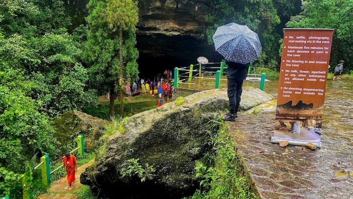
India's southwest monsoon has arrived in the northeast, and it has not come gently.
In the past 24 hours alone, Mawsynram in Meghalaya recorded 53 cm of rainfall, more than double the threshold for extremely heavy rainfall. Cherrapunji, just a few kilometres away and already one of the wettest places on Earth, recorded 47 cm.
The numbers are not anomalies. They are the northeast monsoon doing exactly what it does, arriving at full force while large parts of the rest of the country are still waiting.
As of Monday, June 22, the India Meteorological Department (IMD) has issued warnings for intense rain, landslides, and flooding across northeast India, with the heavy rainfall likely to continue until at least June 25.
WHY DOES NORTHEAST INDIA GET SO MUCH RAIN?
The answer begins with geography.
Northeast India sits at the base of the Eastern Himalayas, where the Bay of Bengal branch of the southwest monsoon funnels enormous volumes of moisture northward and then hits a wall of mountains.
When moist air is forced to rise rapidly over elevated terrain, it cools, condenses, and releases rain in volumes that flatland India rarely sees. This process is called orographic rainfall, which simply means rain produced by mountains forcing air upward.
Mawsynram and Cherrapunji sit on the southern edge of the Meghalaya plateau, directly in the path of this moisture-laden air as it rises from the plains of Bangladesh. The plateau acts like a ramp, and the rain falls in quantities that have made this region the wettest on Earth in recorded history.
WHAT IS THE IMD WARNING ABOUT?
The IMD has flagged several specific risks across the region.
Extremely heavy rainfall has been forecast at isolated places over Assam, Meghalaya, Arunachal Pradesh, and Sub-Himalayan West Bengal and Sikkim. Very heavy rainfall is expected across the broader northeast through June 25.
The weather department has specifically warned of localised flooding and waterlogging in urban areas, landslides and mudslips in hilly terrain, and riverine flooding in vulnerable catchments. These are not precautionary warnings.
The terrain of northeast India, steeply sloped, heavily forested, and cut through by rivers that can rise dramatically in hours, makes it acutely vulnerable to exactly these consequences when rainfall is this intense and sustained.
WHAT ARE LANDSLIDES AND WHY DO THEY HAPPEN HERE?
A landslide occurs when soil, rock, and debris on a slope become saturated with water and lose their grip on the hillside, sliding downward rapidly and with enormous force. In northeast India, where the hills are steep, the soil is deep, and the vegetation is dense, landslides are a predictable consequence of extreme rainfall.
When rain falls faster than the ground can absorb it, water seeps into cracks and spaces between soil particles. This water acts as a lubricant, reducing the friction that holds the slope together.
Once a threshold is crossed, the mass moves. The heavier and more sustained the rainfall, the faster that threshold is reached.
The communities most at risk are those built on or near hillsides, along river valleys, and on roads carved into mountain terrain. The IMD has advised residents in vulnerable areas to stay indoors, avoid travelling on mountain roads, and monitor local alerts.
India's southwest monsoon has arrived in the northeast, and it has not come gently.
In the past 24 hours alone, Mawsynram in Meghalaya recorded 53 cm of rainfall, more than double the threshold for extremely heavy rainfall. Cherrapunji, just a few kilometres away and already one of the wettest places on Earth, recorded 47 cm.
The numbers are not anomalies. They are the northeast monsoon doing exactly what it does, arriving at full force while large parts of the rest of the country are still waiting.
As of Monday, June 22, the India Meteorological Department (IMD) has issued warnings for intense rain, landslides, and flooding across northeast India, with the heavy rainfall likely to continue until at least June 25.
WHY DOES NORTHEAST INDIA GET SO MUCH RAIN?
The answer begins with geography.
Northeast India sits at the base of the Eastern Himalayas, where the Bay of Bengal branch of the southwest monsoon funnels enormous volumes of moisture northward and then hits a wall of mountains.
When moist air is forced to rise rapidly over elevated terrain, it cools, condenses, and releases rain in volumes that flatland India rarely sees. This process is called orographic rainfall, which simply means rain produced by mountains forcing air upward.
Mawsynram and Cherrapunji sit on the southern edge of the Meghalaya plateau, directly in the path of this moisture-laden air as it rises from the plains of Bangladesh. The plateau acts like a ramp, and the rain falls in quantities that have made this region the wettest on Earth in recorded history.
WHAT IS THE IMD WARNING ABOUT?
The IMD has flagged several specific risks across the region.
Extremely heavy rainfall has been forecast at isolated places over Assam, Meghalaya, Arunachal Pradesh, and Sub-Himalayan West Bengal and Sikkim. Very heavy rainfall is expected across the broader northeast through June 25.
The weather department has specifically warned of localised flooding and waterlogging in urban areas, landslides and mudslips in hilly terrain, and riverine flooding in vulnerable catchments. These are not precautionary warnings.
The terrain of northeast India, steeply sloped, heavily forested, and cut through by rivers that can rise dramatically in hours, makes it acutely vulnerable to exactly these consequences when rainfall is this intense and sustained.
WHAT ARE LANDSLIDES AND WHY DO THEY HAPPEN HERE?
A landslide occurs when soil, rock, and debris on a slope become saturated with water and lose their grip on the hillside, sliding downward rapidly and with enormous force. In northeast India, where the hills are steep, the soil is deep, and the vegetation is dense, landslides are a predictable consequence of extreme rainfall.
When rain falls faster than the ground can absorb it, water seeps into cracks and spaces between soil particles. This water acts as a lubricant, reducing the friction that holds the slope together.
Once a threshold is crossed, the mass moves. The heavier and more sustained the rainfall, the faster that threshold is reached.
The communities most at risk are those built on or near hillsides, along river valleys, and on roads carved into mountain terrain. The IMD has advised residents in vulnerable areas to stay indoors, avoid travelling on mountain roads, and monitor local alerts.

