Rain today: Here's when western disturbance will deliver rain in Delhi
A Western Disturbance is set to bring dust storms and rain to Delhi-NCR and parts of north India today. The short spell may offer slight relief from the heatwave, though visibility and local movement could be affected.
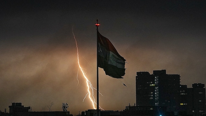
A fresh spell of stormy weather is set to sweep across parts of north India today, with the national capital likely to witness dust storms and rain as a Western Disturbance begins to influence the region.
Several parts of India, including Delhi-NCR, are in the grips of an intense heatwave with temperatures touching close to 45 degrees Celcius. However, a western disturbance on the borders of India is set to deliver rain to break the intense heat cycle.
According to weather assessments, the initial formation of Western Disturbance-induced cloud systems has already begun over bordering areas of Rajasthan. As the system strengthens through the day, it is expected to trigger thunderstorms and gusty winds across adjoining regions.
WHEN WILL IT RAIN?
The weather activity is likely to begin in phases, moving from west to east.
Northern parts of Rajasthan could see storm development between 4 pm and 9 pm, with an estimated 30-50% coverage. This will be followed by an impact over western and southern parts of Haryana between 5 pm and 10 pm, where coverage may increase to 40-60%.
For Delhi NCR, the window of activity is expected later in the evening, between 7 pm and 1 am. Forecasts suggest a 30-60% chance of thunderstorms affecting parts of the region during this period.
The storm pattern is expected to follow a typical sequence seen during such systems. Strong dust-laden winds, reaching speeds of 30 to 60 km/h, may arrive first, reducing visibility and creating brief disruptions.
This is likely to be followed by short spells of moderate rainfall or thundershowers, which could provide temporary relief from the ongoing heat.
Meteorologists note that such weather systems are common during peak summer, when heat buildup combines with incoming moisture and atmospheric instability to trigger evening storms. However, the exact intensity and coverage may vary depending on how the system evolves through the day.
Authorities have advised residents to remain cautious during the evening hours, especially if dark clouds and strong winds begin to develop. Dust storms can lead to sudden drops in visibility, while thunderstorms may bring lightning and localized disruptions.
While the rain is expected to be short-lived, it could help ease temperatures slightly and improve conditions after days of persistent heat. Further updates are likely as the system matures and its trajectory becomes clearer later in the day.