Monsoon arrives in Central India: Thunderstorms, heavy rain expected today
The southwest monsoon pushed into Madhya Pradesh, Chhattisgarh, and Vidarbha on June 24, bringing welcome rain but also thunderstorms and lightning warnings. Here is what Central India can expect over the next week, and why the season is still running 42 per cent below normal.
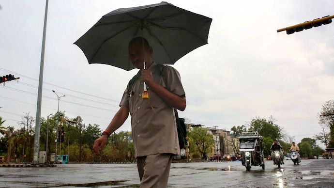
The monsoon has arrived in Central India. And it has not arrived quietly.
The India Meteorological Department (IMD) confirmed on Wednesday, June 24 that the southwest monsoon has pushed into parts of Madhya Pradesh, Gujarat, remaining Maharashtra, and further areas of Chhattisgarh and Jharkhand.
For residents of these states, this means one thing: rain is here, but so is danger.
WHAT EXACTLY IS ARRIVING
The southwest monsoon is not a single event. Think of it less like a curtain being pulled across the sky and more like a giant, slow-moving river of wet air that flows northward from the Indian Ocean every year between June and September, soaking the subcontinent region by region as it goes.
India's monsoon travels in two arms. The Arabian Sea branch sweeps up the west coast, drenching Mumbai and Konkan with spectacular, intense rainfall. Vasai, near Mumbai, received 29 cm of rain in just 24 hours ending on June 24. That is extraordinary.
The Bay of Bengal branch, meanwhile, covers the northeast, and both arms then push inward, meeting over Central India.
It is the push inward that is now under way.
The monsoon moves inland through a mechanism called the monsoon trough, a long zone of low atmospheric pressure that stretches from Rajasthan to the Bay of Bengal. Think of it as a groove in the atmosphere, like a valley that draws the wet air in. As the trough shifts northward, rain follows.
THUNDERSTORMS, LIGHTNING, AND GUSTY WINDS
This is not gentle rain. IMD has warned of thunderstorms with lightning and gusty winds of 40 to 50 kilometres per hour, gusting up to 60 kmph, over East and West Madhya Pradesh from June 25 to 28, and Vidarbha from June 24 to 28.
More seriously, thundersqualls, which are sudden, violent bursts of wind reaching 50 to 60 kmph and gusting to 70 kmph, are expected over West Madhya Pradesh on June 24 and 25, and over East Madhya Pradesh on June 24.
What causes these thunderstorms? When warm, moist air from the ocean pushes over hot land, it rises rapidly. Warm air is lighter, and it shoots upward like a hot-air balloon. As it rises, it cools, and the water vapour inside it condenses into towering storm clouds. The faster and more unstable the air, the more violent the result. This is classic monsoon onset behaviour.
On June 24, hailstorm was reported at isolated places over East Madhya Pradesh. IMD has flagged moderate to severe lightning activity over East and Central India for June 24 and 25.
RELIEF FROM HEAT, BUT NOT EVERYWHERE
Temperatures are expected to gradually fall by 2 to 3 degrees Celsius over Central India as monsoon rains bring in cool, moist air. For a region where maximum temperatures touched 40 to 43 degrees Celsius in recent days, this is welcome.
However, East Uttar Pradesh remains under a heat wave warning for the next four to five days, with northeast Madhya Pradesh and Bihar expected to experience heat wave conditions in the next two to three days. The monsoon has not reached these areas yet.
THE BIGGER PICTURE: A SEASON RUNNING BEHIND
The current advance is significant, but it comes after a difficult start. The monsoon arrived over Kerala on June 4, three days later than the normal date of June 1. A pause then set in during mid-June, caused by a weakening of the large-scale wind systems that drive the monsoon inland.
The result: as of June 24, India's cumulative rainfall stands at 70 mm against a normal of 119.9 mm for the same period. That is a deficit of 42 per cent. Large parts of Madhya Pradesh, Chhattisgarh, Vidarbha, and Odisha have received far below normal rainfall so far.
A contributing factor is El Nino, a periodic warming of the equatorial Pacific Ocean. El Nino disrupts the large-scale atmospheric circulation that normally powers the Indian monsoon, suppressing rainfall.
IMD's seasonal forecast for June to September predicts rainfall at 90 per cent of the long period average, which places the 2026 monsoon season in the below-normal category.
WHAT CENTRAL INDIA SHOULD EXPECT NEXT
Over the coming week, scattered to fairly widespread rainfall is expected across Vidarbha, East and West Madhya Pradesh, and Chhattisgarh. Isolated heavy rainfall is forecast for parts of Madhya Pradesh this week and for Chhattisgarh from June 26 to 29.
The IMD has indicated that conditions are favourable for the monsoon to advance into more parts of Gujarat, Madhya Pradesh, remaining Chhattisgarh, Jharkhand, Bihar, and parts of Uttar Pradesh over the next two to three days.
The rains will bring relief to farmers who have been waiting to sow kharif crops such as soybean, cotton, and pulses. The monsoon is the lifeblood of India's rain-fed agriculture, and Central India, the country's primary farming belt, needs this moisture urgently.
If you are in Madhya Pradesh, Chhattisgarh, or Vidarbha, do not be outside during a thunderstorm. Stay indoors. Do not stand under trees, near tall structures, or in open fields. If you see lightning, move away from water bodies immediately.
The monsoon has arrived. It just needs to be respected.