
3,500-km-long monsoon cloud band seen stretching from China to India

INSAT-3DS captured a vast cloud band stretching from western China to northern and central India. Meteorologists said it reflected the combined upper-level outflow of active monsoon thunderstorms.
 Last UpdatedAug 6, 2026 15:36 IST
 Published by
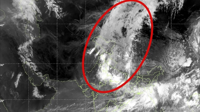
A striking satellite image from India's INSAT-3DS weather satellite has captured a vast cloud band stretching nearly 3,500 kilometres from western China and the Tibetan Plateau across the Himalayas into northern and central India, highlighting the immense scale of the atmospheric processes driving the summer monsoon.
The image, taken in the thermal infrared channel, shows a continuous ribbon of bright white clouds arching across Asia.
While it appears to be a single weather system, meteorologists say it is actually a sprawling canopy of high-altitude ice clouds formed by the combined outflow of multiple powerful thunderstorms embedded within the active monsoon.

Infrared satellite imagery detects the temperature of cloud tops, with the brightest white regions representing the coldest, and therefore highest, clouds in the atmosphere.
These cloud tops often reach altitudes of 10 to 16 kilometres, close to the tropopause.
The extensive cloud shield forms as towering monsoon thunderstorms over northern and central India pump warm, moisture-laden air high into the atmosphere. Once these storms reach their maximum height, their tops spread outward like anvils, producing vast sheets of cirrus clouds composed of tiny ice crystals.

Strong upper-level winds then transport these ice clouds hundreds of kilometres away from the storms that created them. As multiple thunderstorm anvils merge, they form a nearly continuous cloud band stretching across several countries.
The feature visible in the latest INSAT-3DS imagery extends from western China and the Tibetan Plateau over the Himalayas before spreading across northern India, where active monsoon convection continues to fuel widespread rainfall.

Meteorologists say such cloud bands are a classic signature of an active monsoon phase. They indicate vigorous thunderstorm activity beneath the cloud shield and efficient upper-level ventilation, allowing storms to sustain themselves for longer periods.
The cloud band is also influenced by the interaction of large-scale atmospheric circulations, including the Tropical Easterly Jet over peninsular India and stronger upper-level westerlies farther north.
Together, these winds stretch and elongate the cirrus outflow into a feature that can span more than 3,000 kilometres.
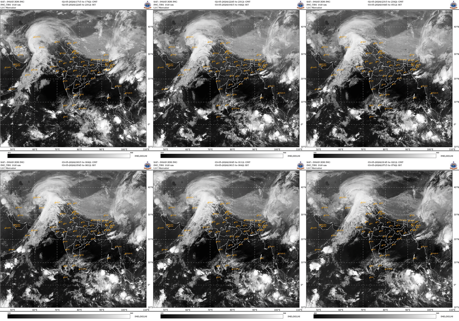
Despite its dramatic appearance, the cloud band is not a single storm, monsoon trough or tropical cyclone. Instead, it is the combined upper-atmospheric signature of numerous monsoon thunderstorms occurring simultaneously across the Indian subcontinent and adjoining regions.
As the southwest monsoon remains active, similar large-scale cloud shields are expected to continue appearing over South Asia, offering a spectacular reminder of the atmosphere's ability to organise weather systems across an entire continent.