
Satellite tracks monsoon's final push over North India, rains to shift South soon

INSAT-3DS imagery shows the southwest monsoon still active across North, Central and East India. Forecast models indicate this phase may ease in the north after mid-September as rainfall shifts south.

 Last UpdatedSep 6, 2026 16:00 IST
 Published by
The southwest monsoon continues to show remarkable strength across large parts of North, Central and East India, with the latest satellite imagery revealing widespread cloud cover and active weather systems stretching across the subcontinent.
Images from the INSAT-3DS satellite show extensive cloud formations over northern and central parts of India, indicating continued atmospheric activity associated with the monsoon. Dense cloud bands are visible across parts of the Himalayan region, the Indo-Gangetic plains and central India, while convective clouds and thunderstorms are also active over eastern and northeastern parts of the country.
The imagery reflects the persistence of the monsoon well into September, a period when seasonal rainfall activity can begin showing signs of a gradual transition.
According to recent weather model projections, however, the active phase is likely to continue for at least another week across large parts of Central, North and East India.
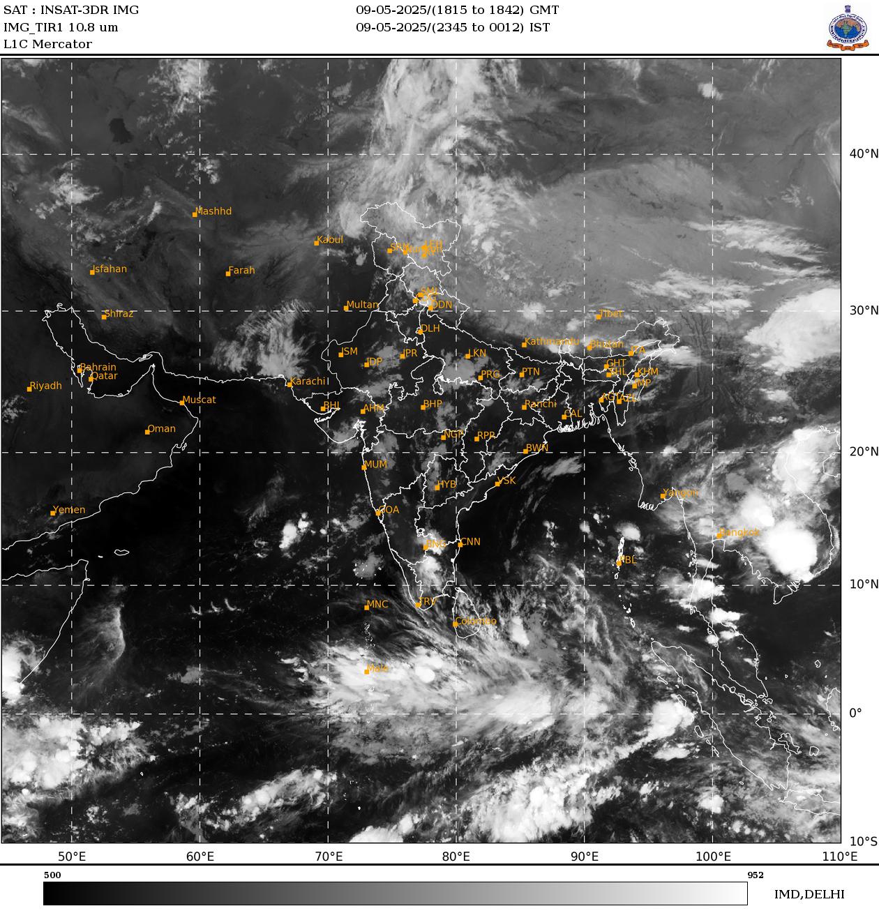
The monsoon is expected to remain active over these regions until around the middle of September, bringing continued spells of rainfall and thunderstorms. The persistence of moisture and favourable atmospheric conditions could keep weather activity elevated across parts of the Indo-Gangetic plains and adjoining regions.
Satellite observations also show extensive cloud development over the Bay of Bengal and eastern India, highlighting the continued availability of moisture feeding weather systems over the region.
But the pattern is expected to undergo a shift in the second half of the month.
Model projections suggest that rainfall activity could increasingly move towards South India after mid-September, as the monsoon circulation begins reorganising.
By around September 20, North and Northwest India could see a significant reduction in rainfall activity, with conditions becoming comparatively drier.

This transition would mark an important change in the seasonal rainfall pattern after weeks of persistent monsoon activity across northern parts of the country.
For now, however, the satellite images underline that the monsoon is far from over.
The continued spread of cloud cover across North and Central India suggests that the atmosphere remains capable of producing widespread rainfall. Localised heavy showers and thunderstorms could continue depending on the development and movement of individual weather systems.
The expected shift towards South India later in September could bring increased rainfall activity to parts of the peninsula, while northern and northwestern regions gradually move towards a drier phase.
The evolving pattern will depend on the movement of weather systems, the position of the monsoon trough and interactions with other atmospheric features.
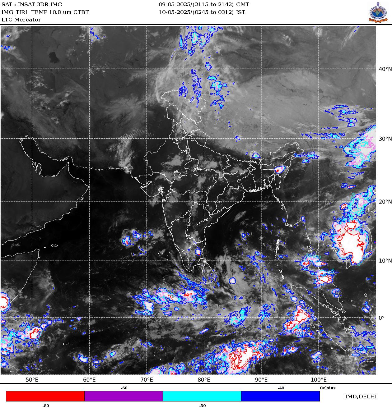
While weather models offer an indication of the broader trend, the timing and intensity of rainfall can still change as new systems develop.
For now, satellite images tell a clear story: the monsoon's grip over North India remains strong, but its next destination could soon be the south.