China's mining operations near glaciers raise Himalayan flood risks, could impact India

A Chinese environmental assessment has identified 156 mining rights in Tibet within five kilometres of glaciers across key transboundary river basins. The finding has sharpened concerns that upstream mining could intensify flood and glacial lake outburst risks downstream.
limate change is already destabilising the region by altering the hydrological and geological conditions. (Photo: Getty)
Bengaluru,Oct 1, 2026 16:13 IST Last UpdatedOct 1, 2026 16:13 IST
  Published by
Last UpdatedOct 1, 2026 16:13 IST Published bySibu Kumar Tripathi
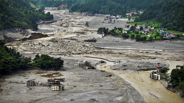
Oct 1, 2026 16:13 ISTChina has blamed climate change for the Nepal-Tibet flood. But climate change is not the whole story. Experts and scientists have increasingly warned that China’s upstream activities in Tibet, including large-scale infrastructure construction, massive militarisation, strategy-driven urbanisation, and dam construction, are destabilising sensitive ecosystems and directly increasing flood and disaster risks across the Himalayas.
Yet, the disaster risks posed by Chinese mining operations near glaciers remain largely under-examined.
A recently released Chinese environmental assessment for the Tibet Autonomous Region's (TAR) Mineral Resources Master Plan draft (2026–2030) documents that 156 of 694 mining rights across the region lie within five kilometres of glaciers, encompassing 1,810.94 square kilometres of glacier area, including several in the headwaters of trans-boundary rivers flowing toward India, Nepal, and Bhutan.
China’s glacier-adjacent mines in the Himalayas, with their detrimental impact on local hydrology and terrain stability, heighten the risk of disasters rapidly affecting communities far downstream.
Instead of addressing these rising disaster risks and the impact of their upstream activities, China has enforced strict information control and moved to normalise the situation in the affected region by rebuilding the G-216 national highway alongside other infrastructure.
CHINA’S GLACIER-ADJACENT MINES ON TRANSBOUNDARY RIVER BASINS
China's own environmental assessment ranking of mining rights and planning units by glacier proximity in TAR shows the exposure is
concentrated on transboundary river basins near the international frontier. Six of the ten highest-ranked mining rights are located within the Yarlung Tsangpo basin alone.
The two highest-ranked mining rights are both on the India-Tibet border. A third mine lies in Lhozhag County, on the Tibet border with Bhutan.
The Tashikhang (Zhashikang) lead-zinc mine in Lhunze County has 158.98 square kilometres of glacier area within its 5-kilometre buffer, constituting the single largest glacier exposure of any mining rights in TAR. It is located on the Chayul Chu, which flows into India’s Upper Subansiri district as the Subansiri River and eventually joins the Brahmaputra.
The second and third highest-ranked glacier-adjacent mines are both associated with the Xiwuxiang polymetallic mining area in Tsona County, with 155.20 square kilometres of glacier area nearby. Similarly, it is directly situated in the Nyamjang Chu (Nyamjang River) valley, and its headwater tributaries flow into India at Tawang district and before joining the Manas River system in Bhutan.
The Cheri Anbopu (Qierianbopu) Lead-Zinc Mine carries 51.78 square kilometres of glacier area within its 5-kilometre buffer. Unlike Lhunze and Tsona, Lhozhag borders Bhutan directly, along a roughly 200-kilometre frontier. The mining site sits near the transboundary river Lhozhag Nub Chu, which enters Bhutan, flows into Kuri Chhu, becomes part of the Manas River, and eventually merges with the Brahmaputra in Assam.
These are only a few critically exposed sites on the most sensitive stretch of border disclosed in the top ten rankings. The broader question is how many glacier-proximate mining operations exist or are planned across the Himalayan border between Tibet and its downstream neighbours, terrain comparable to the already unstable Rasuwa-Kerung corridor. Beyond the glacier-adjacent mines identified above, the Yarlung Tsangpo basin contains TAR’s densest mining footprint, with 48.6 percent of the region’s mining rights located here, according to the aforementioned Chinese official report.
According to ICIMOD and UNDP’s report, at least 47 potentially dangerous glacial lakes are at risk of glacial lake outburst floods (GLOFs), mainly within the China–Nepal transboundary basins alone. Many more unmapped or unknown lakes likely exist across the major transboundary river basins flowing from Tibet, including the Indus, Ganges, Brahmaputra, Salween, Yangtze, Irrawaddy, and Mekong.
THE MECHANISM: FROM EXCAVATION TO OUTBURST
The connection between mining operations near glaciers and downstream flood risks like GLOFs is not hypothetical. The proximity of these mines to the glacier-fed transboundary river system is causing significant additional disturbance to a region that is disaster-prone.
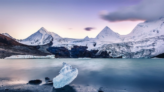
Climate change is already destabilising the region by altering the hydrological and geological conditions. Aggressive human interventions such as excavation, blasting, waste generation, and altered drainage associated with mining could compound existing processes of glacier retreat, permafrost degradation, slope instability, and glacial-lake expansion.
Kyrgyzstan's Kumtor gold mine offers a documented precedent for this exact pathway of mining impacts and downstream flood risk. This mine, operated since 1997, is located directly within a glacierised environment beside the Petrov and Davydov glaciers, at roughly 4,000 metres altitude. A 2015 investigative report by the New Humanitarian warned of a partial or full glacial lake outburst, stating, “Due to mining, the prospect of a GLOF at Kyrgyzstan's Petrov Lake is graver still.”
Peer-reviewed research published the same year also identified direct physical evidence that large-scale mine debris loading can destabilise glaciers in exactly the way that feeds into downstream GLOF hazard.
The study documented that over 775 million tonnes of mine waste dumped onto the Davydov and neighbouring Lysii glaciers between 1998 and 2014 have altered their natural flow dynamics.
This same mechanism, high-altitude mining near glaciated headwaters, is introducing similar aggressive human interference into Tibet’s permafrost and glacier systems already under climate stress, particularly along transboundary systems like the Nyamjang Chu and Subansiri and the wider Himalayan river basins. Ultimately, it is increasing the risk and severity of downstream flooding and other natural disasters.
The recent Nepal-Tibet floods have once again reinvigorated debate over China's mega-dams and other major infrastructure and their threat to downstream countries. Chinese mines near glaciers in Tibet also pose a comparable but far less examined threat.
India, as the primary downstream power with the most at stake, should push Beijing beyond just formal, transparent data-sharing on transboundary rivers and also hold China accountable for its upstream activities such as glacier-adjacent mining that raise such risks. After all, when disaster strikes, it makes no distinction between nationalities.
- Ends