Monsoon deficit at 24%, exceeds the 2002 drought year's final tally: What this means
India's monsoon rainfall deficit has widened to 24 per cent, already bigger than the 19 per cent full-season shortfall of the 2002 drought year. The IMD blames El Nino and a neutral Indian Ocean Dipole, and forecasts heavy rain only over east and northeast India in the coming week.
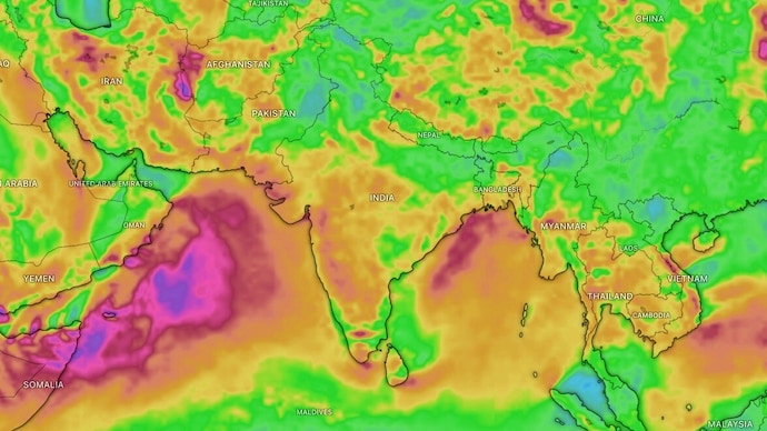
For a few days in July, the monsoon behaved. It covered the whole of India on July 9, just a day behind schedule, and the national rain deficit, which had ballooned past 30 per cent in June, began to shrink.
Then, almost overnight, the taps closed.
WHAT IS INDIA'S MONSOON RAINFALL DEFICIT RIGHT NOW?
Between June 1 and July 16, India received 224.8 mm of rain against a normal of 295.8 mm, a shortfall of 24 per cent, according to the India Meteorological Department (IMD).
That normal is the Long Period Average, or LPA, which is simply the average rainfall India recorded between 1971 and 2020. Think of it as the country's rainfall report card benchmark.
To understand how serious 24 per cent is, rewind to 2002, one of India's worst drought years. That season ended 19 per cent below normal after a catastrophic July. India's deficit in mid-July 2026 is already bigger than 2002's full-season shortfall, making this one of the weakest starts to a monsoon in more than two decades. The two figures are not directly comparable, though, because rains through September can still narrow the gap.
The pain is not spread evenly. East and Northeast India are 36 per cent short, the southern peninsula 26 per cent, Northwest India 19 per cent, and Central India 13 per cent. The week of July 9 to 15 alone was 51 per cent below normal, following the fifth-driest June since 1901.
WHY IS THE MONSOON SO WEAK IN 2026?
The chief suspect is El Nino, an unusual warming of the surface waters of the central and eastern equatorial Pacific Ocean. When that distant patch of sea heats up, it rearranges wind patterns across the globe, weakens the moisture-laden winds crossing the equator, and typically starves India's monsoon. El Nino also drove the 2002 drought, and this year's event is expected to strengthen as the season progresses.
Ordinarily, the Indian Ocean Dipole could ride to the rescue. The IOD is a see-saw of sea temperatures between the western and eastern Indian Ocean, and its positive phase boosts monsoon rain. But the IOD is currently neutral, so it cannot counter El Nino. A third player, the Madden-Julian Oscillation, a travelling pulse of clouds and rain that circles the equator every 30 to 60 days, is also not parked in a rain-friendly position.
WILL IT RAIN IN THE NEXT 7 DAYS?
Yes, but selectively. In its July 16 release, the IMD forecast enhanced rainfall with isolated heavy to very heavy falls over East and Northeast India, East Uttar Pradesh and the Western Himalayan region, covering states such as Uttarakhand and Punjab.
West-central and south peninsular India, however, will stay largely dry for a week. For July as a whole, the IMD expects rainfall below 94 per cent of the LPA.
IS INDIA HEADING FOR A DROUGHT IN 2026?
Not by definition, not yet. The IMD declares a meteorological drought over an area only when seasonal rainfall drops below 75 per cent of the LPA. But a 24 per cent hole in mid-July is uncomfortable territory for kharif crops, the rice, cotton and pulses sown with the monsoon, and for reservoirs that must last until next summer. If the rest of the season underperforms, as forecast, 2026 could rival 2002 in severity.
The monsoon has not failed. It has simply stopped showing up where it is needed most.
For a few days in July, the monsoon behaved. It covered the whole of India on July 9, just a day behind schedule, and the national rain deficit, which had ballooned past 30 per cent in June, began to shrink.
Then, almost overnight, the taps closed.
WHAT IS INDIA'S MONSOON RAINFALL DEFICIT RIGHT NOW?
Between June 1 and July 16, India received 224.8 mm of rain against a normal of 295.8 mm, a shortfall of 24 per cent, according to the India Meteorological Department (IMD).
That normal is the Long Period Average, or LPA, which is simply the average rainfall India recorded between 1971 and 2020. Think of it as the country's rainfall report card benchmark.
To understand how serious 24 per cent is, rewind to 2002, one of India's worst drought years. That season ended 19 per cent below normal after a catastrophic July. India's deficit in mid-July 2026 is already bigger than 2002's full-season shortfall, making this one of the weakest starts to a monsoon in more than two decades. The two figures are not directly comparable, though, because rains through September can still narrow the gap.
The pain is not spread evenly. East and Northeast India are 36 per cent short, the southern peninsula 26 per cent, Northwest India 19 per cent, and Central India 13 per cent. The week of July 9 to 15 alone was 51 per cent below normal, following the fifth-driest June since 1901.
WHY IS THE MONSOON SO WEAK IN 2026?
The chief suspect is El Nino, an unusual warming of the surface waters of the central and eastern equatorial Pacific Ocean. When that distant patch of sea heats up, it rearranges wind patterns across the globe, weakens the moisture-laden winds crossing the equator, and typically starves India's monsoon. El Nino also drove the 2002 drought, and this year's event is expected to strengthen as the season progresses.
Ordinarily, the Indian Ocean Dipole could ride to the rescue. The IOD is a see-saw of sea temperatures between the western and eastern Indian Ocean, and its positive phase boosts monsoon rain. But the IOD is currently neutral, so it cannot counter El Nino. A third player, the Madden-Julian Oscillation, a travelling pulse of clouds and rain that circles the equator every 30 to 60 days, is also not parked in a rain-friendly position.
WILL IT RAIN IN THE NEXT 7 DAYS?
Yes, but selectively. In its July 16 release, the IMD forecast enhanced rainfall with isolated heavy to very heavy falls over East and Northeast India, East Uttar Pradesh and the Western Himalayan region, covering states such as Uttarakhand and Punjab.
West-central and south peninsular India, however, will stay largely dry for a week. For July as a whole, the IMD expects rainfall below 94 per cent of the LPA.
IS INDIA HEADING FOR A DROUGHT IN 2026?
Not by definition, not yet. The IMD declares a meteorological drought over an area only when seasonal rainfall drops below 75 per cent of the LPA. But a 24 per cent hole in mid-July is uncomfortable territory for kharif crops, the rice, cotton and pulses sown with the monsoon, and for reservoirs that must last until next summer. If the rest of the season underperforms, as forecast, 2026 could rival 2002 in severity.
The monsoon has not failed. It has simply stopped showing up where it is needed most.
For a few days in July, the monsoon behaved. It covered the whole of India on July 9, just a day behind schedule, and the national rain deficit, which had ballooned past 30 per cent in June, began to shrink.
Then, almost overnight, the taps closed.
WHAT IS INDIA'S MONSOON RAINFALL DEFICIT RIGHT NOW?
Between June 1 and July 16, India received 224.8 mm of rain against a normal of 295.8 mm, a shortfall of 24 per cent, according to the India Meteorological Department (IMD).
That normal is the Long Period Average, or LPA, which is simply the average rainfall India recorded between 1971 and 2020. Think of it as the country's rainfall report card benchmark.
To understand how serious 24 per cent is, rewind to 2002, one of India's worst drought years. That season ended 19 per cent below normal after a catastrophic July. India's deficit in mid-July 2026 is already bigger than 2002's full-season shortfall, making this one of the weakest starts to a monsoon in more than two decades. The two figures are not directly comparable, though, because rains through September can still narrow the gap.
The pain is not spread evenly. East and Northeast India are 36 per cent short, the southern peninsula 26 per cent, Northwest India 19 per cent, and Central India 13 per cent. The week of July 9 to 15 alone was 51 per cent below normal, following the fifth-driest June since 1901.
WHY IS THE MONSOON SO WEAK IN 2026?
The chief suspect is El Nino, an unusual warming of the surface waters of the central and eastern equatorial Pacific Ocean. When that distant patch of sea heats up, it rearranges wind patterns across the globe, weakens the moisture-laden winds crossing the equator, and typically starves India's monsoon. El Nino also drove the 2002 drought, and this year's event is expected to strengthen as the season progresses.
Ordinarily, the Indian Ocean Dipole could ride to the rescue. The IOD is a see-saw of sea temperatures between the western and eastern Indian Ocean, and its positive phase boosts monsoon rain. But the IOD is currently neutral, so it cannot counter El Nino. A third player, the Madden-Julian Oscillation, a travelling pulse of clouds and rain that circles the equator every 30 to 60 days, is also not parked in a rain-friendly position.
WILL IT RAIN IN THE NEXT 7 DAYS?
Yes, but selectively. In its July 16 release, the IMD forecast enhanced rainfall with isolated heavy to very heavy falls over East and Northeast India, East Uttar Pradesh and the Western Himalayan region, covering states such as Uttarakhand and Punjab.
West-central and south peninsular India, however, will stay largely dry for a week. For July as a whole, the IMD expects rainfall below 94 per cent of the LPA.
IS INDIA HEADING FOR A DROUGHT IN 2026?
Not by definition, not yet. The IMD declares a meteorological drought over an area only when seasonal rainfall drops below 75 per cent of the LPA. But a 24 per cent hole in mid-July is uncomfortable territory for kharif crops, the rice, cotton and pulses sown with the monsoon, and for reservoirs that must last until next summer. If the rest of the season underperforms, as forecast, 2026 could rival 2002 in severity.
The monsoon has not failed. It has simply stopped showing up where it is needed most.

