Rains to lash Uttarakhand, Bihar, Bengal on Saturday. Delhi-NCR to face heat
The monsoon is gaining momentum, with the IMD flagging significant weather activity across several states. Here's what the latest forecast says and which regions should stay prepared.
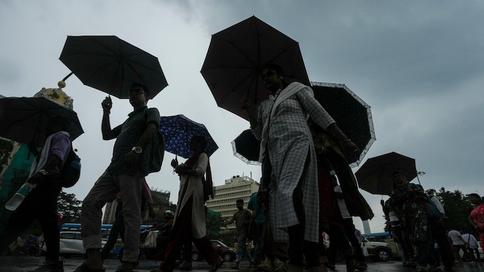
The India Meteorological Department (IMD) has forecast another active monsoon day across large parts of the country on Saturday, July 18, with heavy to very heavy rainfall expected over several northern, eastern and northeastern states.
Isolated extremely heavy rainfall is likely over Sub-Himalayan West Bengal and Sikkim, while Uttarakhand, Chhattisgarh, Assam, Meghalaya and Arunachal Pradesh are also expected to receive intense showers.
The forecast comes as the southwest monsoon remains active over much of India, supported by a low-pressure area over Gangetic West Bengal and adjoining Jharkhand and north Odisha.
According to the IMD, the system is likely to weaken gradually over the next 24 hours, but it will continue to feed moisture into the atmosphere and sustain widespread rainfall across several regions, and revive the monsoon that had been lulled.
HEAVY RAIN IN NORTH AND EAST
For July 18, the IMD has predicted heavy to very heavy rainfall over Arunachal Pradesh, Assam and Meghalaya, Chhattisgarh and Uttarakhand.
Heavy rainfall is also likely in isolated places throughout Bihar, East Uttar Pradesh, Himachal Pradesh, Jharkhand, Odisha, Karnataka, Kerala and Mahe, besides Nagaland, Manipur, Mizoram and Tripura.
Sub-Himalayan West Bengal and Sikkim are expected to receive the most intense rainfall, with isolated pockets likely to witness extremely heavy downpours.
Rain activity is expected to remain widespread over Uttarakhand, Himachal Pradesh, Bihar, Chhattisgarh, Gangetic West Bengal, Jharkhand and the northeastern states through the coming days, indicating that the monsoon is likely to stay active well into next week.
THUNDERSTORMS AND WINDS IN MULTIPLE STATES
Apart from rain, thunderstorms accompanied by lightning and gusty winds are likely over several regions.
Wind speeds of 40-50 kmph are expected at isolated places over Coastal Andhra Pradesh, Interior Karnataka, Madhya Pradesh, Maharashtra, Jharkhand, Ladakh and Jammu & Kashmir.
Lighter gusty winds of 30-40 kmph are forecast over parts of Bihar, Gangetic West Bengal, Kerala, Coastal Karnataka, Tamil Nadu and Rayalaseema, while Telangana may witness thundersqualls with winds reaching 50-60 kmph.
While several states face rain and cold winds, the IMD has said that hot and humid weather is likely to persist over isolated parts of Haryana, Chandigarh, Delhi and Punjab despite the ongoing monsoon.
Saturday is set to be another day of widespread rain and isolated heat, a coexistence that has grown frequent in an already uneven season.
The India Meteorological Department (IMD) has forecast another active monsoon day across large parts of the country on Saturday, July 18, with heavy to very heavy rainfall expected over several northern, eastern and northeastern states.
Isolated extremely heavy rainfall is likely over Sub-Himalayan West Bengal and Sikkim, while Uttarakhand, Chhattisgarh, Assam, Meghalaya and Arunachal Pradesh are also expected to receive intense showers.
The forecast comes as the southwest monsoon remains active over much of India, supported by a low-pressure area over Gangetic West Bengal and adjoining Jharkhand and north Odisha.
According to the IMD, the system is likely to weaken gradually over the next 24 hours, but it will continue to feed moisture into the atmosphere and sustain widespread rainfall across several regions, and revive the monsoon that had been lulled.
HEAVY RAIN IN NORTH AND EAST
For July 18, the IMD has predicted heavy to very heavy rainfall over Arunachal Pradesh, Assam and Meghalaya, Chhattisgarh and Uttarakhand.
Heavy rainfall is also likely in isolated places throughout Bihar, East Uttar Pradesh, Himachal Pradesh, Jharkhand, Odisha, Karnataka, Kerala and Mahe, besides Nagaland, Manipur, Mizoram and Tripura.
Sub-Himalayan West Bengal and Sikkim are expected to receive the most intense rainfall, with isolated pockets likely to witness extremely heavy downpours.
Rain activity is expected to remain widespread over Uttarakhand, Himachal Pradesh, Bihar, Chhattisgarh, Gangetic West Bengal, Jharkhand and the northeastern states through the coming days, indicating that the monsoon is likely to stay active well into next week.
THUNDERSTORMS AND WINDS IN MULTIPLE STATES
Apart from rain, thunderstorms accompanied by lightning and gusty winds are likely over several regions.
Wind speeds of 40-50 kmph are expected at isolated places over Coastal Andhra Pradesh, Interior Karnataka, Madhya Pradesh, Maharashtra, Jharkhand, Ladakh and Jammu & Kashmir.
Lighter gusty winds of 30-40 kmph are forecast over parts of Bihar, Gangetic West Bengal, Kerala, Coastal Karnataka, Tamil Nadu and Rayalaseema, while Telangana may witness thundersqualls with winds reaching 50-60 kmph.
While several states face rain and cold winds, the IMD has said that hot and humid weather is likely to persist over isolated parts of Haryana, Chandigarh, Delhi and Punjab despite the ongoing monsoon.
Saturday is set to be another day of widespread rain and isolated heat, a coexistence that has grown frequent in an already uneven season.
The India Meteorological Department (IMD) has forecast another active monsoon day across large parts of the country on Saturday, July 18, with heavy to very heavy rainfall expected over several northern, eastern and northeastern states.
Isolated extremely heavy rainfall is likely over Sub-Himalayan West Bengal and Sikkim, while Uttarakhand, Chhattisgarh, Assam, Meghalaya and Arunachal Pradesh are also expected to receive intense showers.
The forecast comes as the southwest monsoon remains active over much of India, supported by a low-pressure area over Gangetic West Bengal and adjoining Jharkhand and north Odisha.
According to the IMD, the system is likely to weaken gradually over the next 24 hours, but it will continue to feed moisture into the atmosphere and sustain widespread rainfall across several regions, and revive the monsoon that had been lulled.
HEAVY RAIN IN NORTH AND EAST
For July 18, the IMD has predicted heavy to very heavy rainfall over Arunachal Pradesh, Assam and Meghalaya, Chhattisgarh and Uttarakhand.
Heavy rainfall is also likely in isolated places throughout Bihar, East Uttar Pradesh, Himachal Pradesh, Jharkhand, Odisha, Karnataka, Kerala and Mahe, besides Nagaland, Manipur, Mizoram and Tripura.
Sub-Himalayan West Bengal and Sikkim are expected to receive the most intense rainfall, with isolated pockets likely to witness extremely heavy downpours.
Rain activity is expected to remain widespread over Uttarakhand, Himachal Pradesh, Bihar, Chhattisgarh, Gangetic West Bengal, Jharkhand and the northeastern states through the coming days, indicating that the monsoon is likely to stay active well into next week.
THUNDERSTORMS AND WINDS IN MULTIPLE STATES
Apart from rain, thunderstorms accompanied by lightning and gusty winds are likely over several regions.
Wind speeds of 40-50 kmph are expected at isolated places over Coastal Andhra Pradesh, Interior Karnataka, Madhya Pradesh, Maharashtra, Jharkhand, Ladakh and Jammu & Kashmir.
Lighter gusty winds of 30-40 kmph are forecast over parts of Bihar, Gangetic West Bengal, Kerala, Coastal Karnataka, Tamil Nadu and Rayalaseema, while Telangana may witness thundersqualls with winds reaching 50-60 kmph.
While several states face rain and cold winds, the IMD has said that hot and humid weather is likely to persist over isolated parts of Haryana, Chandigarh, Delhi and Punjab despite the ongoing monsoon.
Saturday is set to be another day of widespread rain and isolated heat, a coexistence that has grown frequent in an already uneven season.

