Monsoon unstoppable: Heavy showers in Gujarat, rain across India on Friday
An active monsoon system continues to dominate India's weather, with a slow-moving depression expected to keep rainfall intense across several regions.
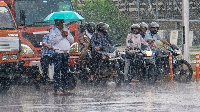
Large parts of the country are set to remain under the grip of an active southwest monsoon on Friday, July 31, with the India Meteorological Department (IMD) forecasting widespread rain and thunderstorms across several regions.
Gujarat is likely to bear the brunt of the wet spell, while heavy rainfall is also expected over parts of north, central, west and northeast India.
The ongoing spell is being driven by a deep depression over west-central Chhattisgarh and adjoining Vidarbha and southeast Madhya Pradesh.
The weather system is expected to weaken into a depression while moving west-northwest across Vidarbha and adjoining south Madhya Pradesh over the next 24 hours, continuing to fuel widespread monsoon activity.
GUJARAT FACES MONSOON'S WRATH
The IMD has forecast heavy to very heavy rainfall with isolated extremely heavy showers over Gujarat and parts of Maharashtra on Friday.
It has also warned of the possibility of exceptionally heavy rainfall over the Gujarat region, making it the country's primary rainfall hotspot for the day.
Apart from Gujarat, heavy to very heavy rainfall is likely over Arunachal Pradesh, east Rajasthan, west Madhya Pradesh, Konkan and Goa, Karnataka, Kerala and Mahe, and Punjab.
Heavy rainfall is also expected at isolated places throughout Haryana, Delhi, Himachal Pradesh, Uttarakhand, Jammu and Kashmir, Bihar, Vidarbha, Telangana, Sub-Himalayan West Bengal and Sikkim, Lakshadweep and parts of the Northeast.
THUNDERSTORMS TO ACCOMPANY HEAVY RAIN
Thunderstorms accompanied by lightning and gusty winds of 40-50 kmph are likely over parts of Andhra Pradesh, interior Karnataka, Jharkhand, Kerala, Lakshadweep and west Madhya Pradesh.
Winds of 30-40 kmph are also expected over Bihar, Odisha, Rajasthan, Telangana, coastal Karnataka, east Madhya Pradesh and Gangetic West Bengal.
The latest forecast comes after several states recorded intense rainfall over the past 24 hours.
Extremely heavy rain was observed in parts of Chhattisgarh, while heavy to very heavy rainfall lashed Odisha, Madhya Pradesh, Vidarbha and Telangana.
Heavy showers were also reported from Uttarakhand, parts of Maharashtra, Arunachal Pradesh and Assam and Meghalaya.
According to the IMD's forecast, fairly widespread to widespread rainfall is likely to continue across large parts of northwest, central, west and eastern India over the coming days as the southwest monsoon remains active.
Large parts of the country are set to remain under the grip of an active southwest monsoon on Friday, July 31, with the India Meteorological Department (IMD) forecasting widespread rain and thunderstorms across several regions.
Gujarat is likely to bear the brunt of the wet spell, while heavy rainfall is also expected over parts of north, central, west and northeast India.
The ongoing spell is being driven by a deep depression over west-central Chhattisgarh and adjoining Vidarbha and southeast Madhya Pradesh.
The weather system is expected to weaken into a depression while moving west-northwest across Vidarbha and adjoining south Madhya Pradesh over the next 24 hours, continuing to fuel widespread monsoon activity.
GUJARAT FACES MONSOON'S WRATH
The IMD has forecast heavy to very heavy rainfall with isolated extremely heavy showers over Gujarat and parts of Maharashtra on Friday.
It has also warned of the possibility of exceptionally heavy rainfall over the Gujarat region, making it the country's primary rainfall hotspot for the day.
Apart from Gujarat, heavy to very heavy rainfall is likely over Arunachal Pradesh, east Rajasthan, west Madhya Pradesh, Konkan and Goa, Karnataka, Kerala and Mahe, and Punjab.
Heavy rainfall is also expected at isolated places throughout Haryana, Delhi, Himachal Pradesh, Uttarakhand, Jammu and Kashmir, Bihar, Vidarbha, Telangana, Sub-Himalayan West Bengal and Sikkim, Lakshadweep and parts of the Northeast.
THUNDERSTORMS TO ACCOMPANY HEAVY RAIN
Thunderstorms accompanied by lightning and gusty winds of 40-50 kmph are likely over parts of Andhra Pradesh, interior Karnataka, Jharkhand, Kerala, Lakshadweep and west Madhya Pradesh.
Winds of 30-40 kmph are also expected over Bihar, Odisha, Rajasthan, Telangana, coastal Karnataka, east Madhya Pradesh and Gangetic West Bengal.
The latest forecast comes after several states recorded intense rainfall over the past 24 hours.
Extremely heavy rain was observed in parts of Chhattisgarh, while heavy to very heavy rainfall lashed Odisha, Madhya Pradesh, Vidarbha and Telangana.
Heavy showers were also reported from Uttarakhand, parts of Maharashtra, Arunachal Pradesh and Assam and Meghalaya.
According to the IMD's forecast, fairly widespread to widespread rainfall is likely to continue across large parts of northwest, central, west and eastern India over the coming days as the southwest monsoon remains active.
Large parts of the country are set to remain under the grip of an active southwest monsoon on Friday, July 31, with the India Meteorological Department (IMD) forecasting widespread rain and thunderstorms across several regions.
Gujarat is likely to bear the brunt of the wet spell, while heavy rainfall is also expected over parts of north, central, west and northeast India.
The ongoing spell is being driven by a deep depression over west-central Chhattisgarh and adjoining Vidarbha and southeast Madhya Pradesh.
The weather system is expected to weaken into a depression while moving west-northwest across Vidarbha and adjoining south Madhya Pradesh over the next 24 hours, continuing to fuel widespread monsoon activity.
GUJARAT FACES MONSOON'S WRATH
The IMD has forecast heavy to very heavy rainfall with isolated extremely heavy showers over Gujarat and parts of Maharashtra on Friday.
It has also warned of the possibility of exceptionally heavy rainfall over the Gujarat region, making it the country's primary rainfall hotspot for the day.
Apart from Gujarat, heavy to very heavy rainfall is likely over Arunachal Pradesh, east Rajasthan, west Madhya Pradesh, Konkan and Goa, Karnataka, Kerala and Mahe, and Punjab.
Heavy rainfall is also expected at isolated places throughout Haryana, Delhi, Himachal Pradesh, Uttarakhand, Jammu and Kashmir, Bihar, Vidarbha, Telangana, Sub-Himalayan West Bengal and Sikkim, Lakshadweep and parts of the Northeast.
THUNDERSTORMS TO ACCOMPANY HEAVY RAIN
Thunderstorms accompanied by lightning and gusty winds of 40-50 kmph are likely over parts of Andhra Pradesh, interior Karnataka, Jharkhand, Kerala, Lakshadweep and west Madhya Pradesh.
Winds of 30-40 kmph are also expected over Bihar, Odisha, Rajasthan, Telangana, coastal Karnataka, east Madhya Pradesh and Gangetic West Bengal.
The latest forecast comes after several states recorded intense rainfall over the past 24 hours.
Extremely heavy rain was observed in parts of Chhattisgarh, while heavy to very heavy rainfall lashed Odisha, Madhya Pradesh, Vidarbha and Telangana.
Heavy showers were also reported from Uttarakhand, parts of Maharashtra, Arunachal Pradesh and Assam and Meghalaya.
According to the IMD's forecast, fairly widespread to widespread rainfall is likely to continue across large parts of northwest, central, west and eastern India over the coming days as the southwest monsoon remains active.

