Yamuna in Delhi has narrowed 68%, lost 89% of its flow since 1799: Study
A new study has traced the Yamuna's transformation in Delhi from 1799 to 2024 using archival maps and satellite imagery. It shows urban interventions have sharply reduced the river's width and flow, worsening flood vulnerability.
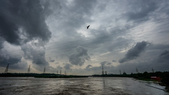

A first-of-its-kind study has used an archival map from 1799 to trace how the Yamuna has changed over more than 200 years, showing that the river flowing through Delhi has become far narrower and carries much less water than it once did. Researchers found that the river has narrowed by about 68 per cent and that its discharge, or the volume of water flowing through it, has dropped by around 89 per cent since the late 18th century.
The study, carried out by researchers from the Department of Geology at the University of Delhi and the Indian Institute of Science Education and Research, Bhopal, says human intervention and urbanisation have sharply altered the river. It found that barrages, canals, embankments and development on the floodplains have changed the Yamuna from a wider, freer river into a more constrained one that is less able to cope with floods.
The findings, accessed by PTI, have been published in the paper, "Two Centuries of Hydrogeomorphic Changes: Width-Discharge Dynamics of the Urbanised Yamuna River in Delhi". To reconstruct the river's past, the researchers used an archival map prepared by Upjohn in 1799 and preserved in the National Archives of India, along with historical maps and modern satellite images. "People have talked about changes in the Yamuna river in the Delhi stretch, but no one has talked about the changes in its discharge in the stretch on this timescale," Professor Vimal Singh, one of the researchers, said.
The researchers said the 1799 map showed the Yamuna before any barrages were built across it, offering a rare view of its natural state. They found that the river's average bankfull width, or the width when it is full but not overflowing its banks, reduced from about 658 metres in 1799 to around 210 metres in 2024. Using this width, they estimated that the river's discharge fell from about 30,000 cubic metres per second in 1799 to roughly 3,900 cubic metres per second in 2024.
The study said these changes took place as Delhi's population rose from around 2.5 lakh in the early 19th century to nearly 2.15 crore in 2024. Drawing on historical records, census data and population projections, it said Delhi had a population of around 1.5 lakh in 1630 during the reign of Mughal emperor Shah Jahan. The city's population stood at around four lakh in 1901, rose to about 9.2 lakh by the 1940s and jumped to 17.44 lakh in the 1950s following Independence and Partition. The researchers also noted that Delhi occupies just 0.05 per cent of India's land area but is home to nearly 1.5 per cent of the country's population, putting heavy pressure on the river.
According to the study, the first major intervention came with the British-built Tajewala barrage in 1873, followed by the Okhla barrage in 1874, the Wazirabad barrage in 1959 and the ITO Barrage in 1966-67. These structures diverted large volumes of water upstream and fundamentally changed the river's natural flow through Delhi. The researchers noted that the Yamuna flows for about 50 kilometres through Delhi, one of the most heavily modified stretches of the Himalayan river. Around 22 kilometres of this stretch are controlled by the Wazirabad and Okhla barrages, while 18 municipal drains discharge into the river.
The study also found that between 1912 and 2024, around 45 square kilometres of Delhi's floodplains, the low-lying land beside the river that naturally stores floodwater, became disconnected because of embankments built to protect the city from floods. Many of these areas were later converted for farming and urban development. It also recorded a sharp decline in channel bars, the sandy islands that form naturally within the river, whose total area fell from about 20 square kilometres in 1985 to just four square kilometres in 2020, with many altered or turned into agricultural land.
Researchers said these changes have weakened the river's natural ability to deal with floods. Floodplains usually allow excess water to spread out during heavy rain, but embankments and urban development now confine much of the flow within the river channel, increasing flood levels. They cited the July 2023 floods in Delhi as an example. Around 20,076 cubic metres of water per second was released upstream during the 1978 floods, nearly double the 10,187 cubic metres per second released during the 2023 floods. Yet the river reached a higher water level in Delhi in 2023 because it has become narrower and more constrained over time, the researchers said.
To map the Yamuna's transformation, the team compared the 1799 map with maps from 1893, 1924 and 1955, and also analysed Landsat satellite images from 1986 onwards and Sentinel-1 radar imagery. They manually measured the river's width and used an established relationship between river width and discharge to estimate how much water it carried during different periods. Radar imagery was used during the monsoon because it can capture the river through cloud cover. The researchers said historical maps have some limitations because mapping techniques from that period are not fully documented, and the 1799 map does not show channel bars, but added that these records provide the best available evidence to reconstruct the Yamuna's past over two centuries.
The study concludes that human interventions, rather than natural changes, have transformed the Yamuna in Delhi into a much narrower, lower-flow river with reduced ability to withstand extreme weather events, capturing the scale of the river's change over more than 200 years.