Monsoon to drench Central India on Wednesday: Heavy rain in MP, Chhattisgarh
A powerful weather system is set to revive rainfall across much of India. Here's where the heaviest rain is expected and why the monsoon has turned active once again.
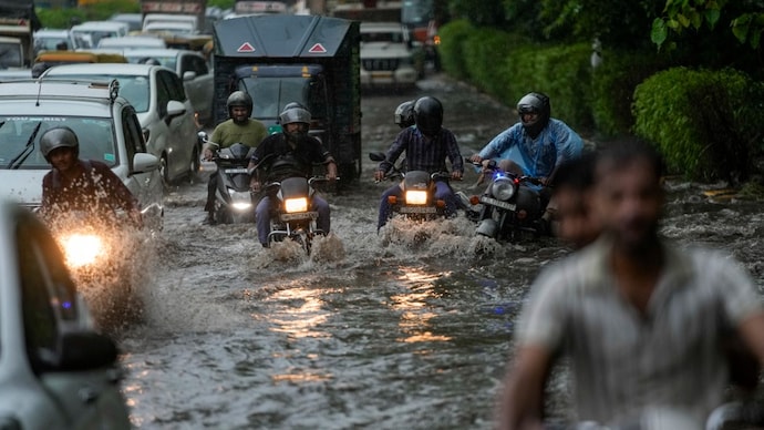
A deep depression that formed over the Bay of Bengal has moved inland and is expected to continue tracking west-northwest across north Odisha, south Jharkhand and north Chhattisgarh over the next 24 hours, keeping large parts of central and northern India under the spell of widespread rain on Wednesday, July 29, according to the India Meteorological Department (IMD).
The weather system, which lay centred over north interior Odisha and adjoining Jharkhand and Gangetic West Bengal on Tuesday afternoon, is expected to shift further inland, carrying moisture deep into central India.
This is likely to trigger spells of heavy to extremely heavy rainfall in several states, while rain activity continues across much of the country under the active southwest monsoon.
CENTRAL INDIA TO BE DRENCHED
The IMD has forecast heavy to very heavy rainfall with isolated extremely heavy rainfall over Chhattisgarh, east Madhya Pradesh and Vidarbha on July 29.
Heavy to very heavy rain is also expected at isolated places in west Madhya Pradesh, Odisha, Haryana, Delhi, Punjab, Himachal Pradesh, Uttarakhand and parts of the Northeast.
Heavy rainfall is also likely over Jharkhand, Uttar Pradesh, Coastal Andhra Pradesh, Telangana, Karnataka, Kerala, Konkan and Goa, Marathwada, Jammu and Kashmir, Assam, Meghalaya and Arunachal Pradesh.
Thunderstorms accompanied by lightning and gusty winds are expected in many of these regions, with wind speeds reaching 30-50 kmph at isolated places.
Furthermore, Odisha will continue to receive very heavy rainfall at isolated places on Wednesday, while north Chhattisgarh remains at risk of extremely heavy rain as the deep depression moves inland.
East Madhya Pradesh is also likely to witness isolated spells of extremely heavy rainfall.
MONSOON REMAINS ACTIVE
The ongoing spell follows intense rainfall recorded over the past 24 hours, with Balasore in Odisha receiving 25 cm of rain, while several locations in Jharkhand, Chhattisgarh and east Madhya Pradesh also reported heavy downpours.
The southwest monsoon typically draws strength from low-pressure systems that develop over the Bay of Bengal.
As these systems travel inland, they spread moisture across eastern, central and northern India, often resulting in widespread rainfall.
The IMD expects this deep depression to maintain an active monsoon pattern over central India through Wednesday before gradually weakening as it moves farther west.
A deep depression that formed over the Bay of Bengal has moved inland and is expected to continue tracking west-northwest across north Odisha, south Jharkhand and north Chhattisgarh over the next 24 hours, keeping large parts of central and northern India under the spell of widespread rain on Wednesday, July 29, according to the India Meteorological Department (IMD).
The weather system, which lay centred over north interior Odisha and adjoining Jharkhand and Gangetic West Bengal on Tuesday afternoon, is expected to shift further inland, carrying moisture deep into central India.
This is likely to trigger spells of heavy to extremely heavy rainfall in several states, while rain activity continues across much of the country under the active southwest monsoon.
CENTRAL INDIA TO BE DRENCHED
The IMD has forecast heavy to very heavy rainfall with isolated extremely heavy rainfall over Chhattisgarh, east Madhya Pradesh and Vidarbha on July 29.
Heavy to very heavy rain is also expected at isolated places in west Madhya Pradesh, Odisha, Haryana, Delhi, Punjab, Himachal Pradesh, Uttarakhand and parts of the Northeast.
Heavy rainfall is also likely over Jharkhand, Uttar Pradesh, Coastal Andhra Pradesh, Telangana, Karnataka, Kerala, Konkan and Goa, Marathwada, Jammu and Kashmir, Assam, Meghalaya and Arunachal Pradesh.
Thunderstorms accompanied by lightning and gusty winds are expected in many of these regions, with wind speeds reaching 30-50 kmph at isolated places.
Furthermore, Odisha will continue to receive very heavy rainfall at isolated places on Wednesday, while north Chhattisgarh remains at risk of extremely heavy rain as the deep depression moves inland.
East Madhya Pradesh is also likely to witness isolated spells of extremely heavy rainfall.
MONSOON REMAINS ACTIVE
The ongoing spell follows intense rainfall recorded over the past 24 hours, with Balasore in Odisha receiving 25 cm of rain, while several locations in Jharkhand, Chhattisgarh and east Madhya Pradesh also reported heavy downpours.
The southwest monsoon typically draws strength from low-pressure systems that develop over the Bay of Bengal.
As these systems travel inland, they spread moisture across eastern, central and northern India, often resulting in widespread rainfall.
The IMD expects this deep depression to maintain an active monsoon pattern over central India through Wednesday before gradually weakening as it moves farther west.
A deep depression that formed over the Bay of Bengal has moved inland and is expected to continue tracking west-northwest across north Odisha, south Jharkhand and north Chhattisgarh over the next 24 hours, keeping large parts of central and northern India under the spell of widespread rain on Wednesday, July 29, according to the India Meteorological Department (IMD).
The weather system, which lay centred over north interior Odisha and adjoining Jharkhand and Gangetic West Bengal on Tuesday afternoon, is expected to shift further inland, carrying moisture deep into central India.
This is likely to trigger spells of heavy to extremely heavy rainfall in several states, while rain activity continues across much of the country under the active southwest monsoon.
CENTRAL INDIA TO BE DRENCHED
The IMD has forecast heavy to very heavy rainfall with isolated extremely heavy rainfall over Chhattisgarh, east Madhya Pradesh and Vidarbha on July 29.
Heavy to very heavy rain is also expected at isolated places in west Madhya Pradesh, Odisha, Haryana, Delhi, Punjab, Himachal Pradesh, Uttarakhand and parts of the Northeast.
Heavy rainfall is also likely over Jharkhand, Uttar Pradesh, Coastal Andhra Pradesh, Telangana, Karnataka, Kerala, Konkan and Goa, Marathwada, Jammu and Kashmir, Assam, Meghalaya and Arunachal Pradesh.
Thunderstorms accompanied by lightning and gusty winds are expected in many of these regions, with wind speeds reaching 30-50 kmph at isolated places.
Furthermore, Odisha will continue to receive very heavy rainfall at isolated places on Wednesday, while north Chhattisgarh remains at risk of extremely heavy rain as the deep depression moves inland.
East Madhya Pradesh is also likely to witness isolated spells of extremely heavy rainfall.
MONSOON REMAINS ACTIVE
The ongoing spell follows intense rainfall recorded over the past 24 hours, with Balasore in Odisha receiving 25 cm of rain, while several locations in Jharkhand, Chhattisgarh and east Madhya Pradesh also reported heavy downpours.
The southwest monsoon typically draws strength from low-pressure systems that develop over the Bay of Bengal.
As these systems travel inland, they spread moisture across eastern, central and northern India, often resulting in widespread rainfall.
The IMD expects this deep depression to maintain an active monsoon pattern over central India through Wednesday before gradually weakening as it moves farther west.

