Why cloudy Chennai stays dry in July while south Tamil Nadu gets thunderstorms
Chennai stays cloudy and capped at 35 to 36 degrees Celsius while south Tamil Nadu braces for evening thunderstorms. Here is the science of rain shadows, sea breezes and remnant monsoon moisture shaping Tamil Nadu weather.
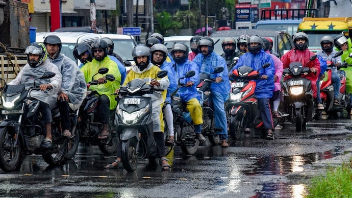
In Chennai this July, the sky is grey, but the ground is dry. On the west coast, it is pouring. And somewhere near Tamil Nadu's Ramanathapuram, a thunderstorm is quietly assembling itself for the evening.
All three are chapters of the same story.
WHY IS CHENNAI CLOUDY BUT NOT RAINY IN JULY?
Clouds are nature's sunshade. They reflect a large share of incoming sunlight back into space before it can heat the ground, a property scientists call albedo.
A cloudy morning therefore robs the afternoon of its fuel, capping Chennai at 35 to 36 degrees Celsius when a clear July day can push the city towards 39 or 40.
But why no rain? Blame a mountain wall. The southwest monsoon winds arrive soaked from the Arabian Sea, slam into the Western Ghats, rise, cool and empty themselves over Kerala. What crosses over is air that has already spent its moisture.
As it descends the eastern slopes, it compresses and warms, like air squeezed into a bicycle pump. Tamil Nadu sits in this rain shadow, which is why Chennai waits for the northeast monsoon in October for its real rains.
WHY DOES CHENNAI GET RAIN AT NIGHT?
The Ghats do not wring out every drop.
When the monsoon is vigorous on the west coast, leftover moisture rides the westerly winds across the peninsula and reaches Chennai hours later, by evening or night.
Night helps in another way. After sunset, the daytime churning of air that shreds clouds switches off, while cloud tops cool and destabilise the air above.
The result is light to moderate rain in a few places while the city sleeps.
WHY DOES SOUTH TAMIL NADU GET EVENING THUNDERSTORMS?
Over Ramanathapuram, Sivagangai and Pudukottai, two winds collide. All day, the Sun bakes the land, and by afternoon, the air holds enormous stored energy, which meteorologists call convective available potential energy (CAPE).
Meanwhile, cool, humid air pushes inland from the Gulf of Mannar and Palk Strait as a sea breeze.
Radar studies over Chennai show this sea breeze front can penetrate about 80 kilometres inland.
Where the marine air meets the hot, dry westerlies, air is shoved violently upward. The moisture condenses, releases heat, and a cumulonimbus cloud erupts. That is why the storms are convective, localised, and strictly an evening affair.
WHY DO RAINS RETURN TO THE WEST COAST?
Monsoon rain pulses. When the Somali Jet, the fast low-level wind ribbon ferrying moisture across the Arabian Sea, strengthens, the Ghats force that air upward, it cools, and rain spreads to more places from Kerala to Konkan.
And when the west coast roars, Chennai listens. More rain there means more remnant moisture drifting east, and better odds of a midnight drizzle on the Coromandel coast.
In Chennai this July, the sky is grey, but the ground is dry. On the west coast, it is pouring. And somewhere near Tamil Nadu's Ramanathapuram, a thunderstorm is quietly assembling itself for the evening.
All three are chapters of the same story.
WHY IS CHENNAI CLOUDY BUT NOT RAINY IN JULY?
Clouds are nature's sunshade. They reflect a large share of incoming sunlight back into space before it can heat the ground, a property scientists call albedo.
A cloudy morning therefore robs the afternoon of its fuel, capping Chennai at 35 to 36 degrees Celsius when a clear July day can push the city towards 39 or 40.
But why no rain? Blame a mountain wall. The southwest monsoon winds arrive soaked from the Arabian Sea, slam into the Western Ghats, rise, cool and empty themselves over Kerala. What crosses over is air that has already spent its moisture.
As it descends the eastern slopes, it compresses and warms, like air squeezed into a bicycle pump. Tamil Nadu sits in this rain shadow, which is why Chennai waits for the northeast monsoon in October for its real rains.
WHY DOES CHENNAI GET RAIN AT NIGHT?
The Ghats do not wring out every drop.
When the monsoon is vigorous on the west coast, leftover moisture rides the westerly winds across the peninsula and reaches Chennai hours later, by evening or night.
Night helps in another way. After sunset, the daytime churning of air that shreds clouds switches off, while cloud tops cool and destabilise the air above.
The result is light to moderate rain in a few places while the city sleeps.
WHY DOES SOUTH TAMIL NADU GET EVENING THUNDERSTORMS?
Over Ramanathapuram, Sivagangai and Pudukottai, two winds collide. All day, the Sun bakes the land, and by afternoon, the air holds enormous stored energy, which meteorologists call convective available potential energy (CAPE).
Meanwhile, cool, humid air pushes inland from the Gulf of Mannar and Palk Strait as a sea breeze.
Radar studies over Chennai show this sea breeze front can penetrate about 80 kilometres inland.
Where the marine air meets the hot, dry westerlies, air is shoved violently upward. The moisture condenses, releases heat, and a cumulonimbus cloud erupts. That is why the storms are convective, localised, and strictly an evening affair.
WHY DO RAINS RETURN TO THE WEST COAST?
Monsoon rain pulses. When the Somali Jet, the fast low-level wind ribbon ferrying moisture across the Arabian Sea, strengthens, the Ghats force that air upward, it cools, and rain spreads to more places from Kerala to Konkan.
And when the west coast roars, Chennai listens. More rain there means more remnant moisture drifting east, and better odds of a midnight drizzle on the Coromandel coast.
In Chennai this July, the sky is grey, but the ground is dry. On the west coast, it is pouring. And somewhere near Tamil Nadu's Ramanathapuram, a thunderstorm is quietly assembling itself for the evening.
All three are chapters of the same story.
WHY IS CHENNAI CLOUDY BUT NOT RAINY IN JULY?
Clouds are nature's sunshade. They reflect a large share of incoming sunlight back into space before it can heat the ground, a property scientists call albedo.
A cloudy morning therefore robs the afternoon of its fuel, capping Chennai at 35 to 36 degrees Celsius when a clear July day can push the city towards 39 or 40.
But why no rain? Blame a mountain wall. The southwest monsoon winds arrive soaked from the Arabian Sea, slam into the Western Ghats, rise, cool and empty themselves over Kerala. What crosses over is air that has already spent its moisture.
As it descends the eastern slopes, it compresses and warms, like air squeezed into a bicycle pump. Tamil Nadu sits in this rain shadow, which is why Chennai waits for the northeast monsoon in October for its real rains.
WHY DOES CHENNAI GET RAIN AT NIGHT?
The Ghats do not wring out every drop.
When the monsoon is vigorous on the west coast, leftover moisture rides the westerly winds across the peninsula and reaches Chennai hours later, by evening or night.
Night helps in another way. After sunset, the daytime churning of air that shreds clouds switches off, while cloud tops cool and destabilise the air above.
The result is light to moderate rain in a few places while the city sleeps.
WHY DOES SOUTH TAMIL NADU GET EVENING THUNDERSTORMS?
Over Ramanathapuram, Sivagangai and Pudukottai, two winds collide. All day, the Sun bakes the land, and by afternoon, the air holds enormous stored energy, which meteorologists call convective available potential energy (CAPE).
Meanwhile, cool, humid air pushes inland from the Gulf of Mannar and Palk Strait as a sea breeze.
Radar studies over Chennai show this sea breeze front can penetrate about 80 kilometres inland.
Where the marine air meets the hot, dry westerlies, air is shoved violently upward. The moisture condenses, releases heat, and a cumulonimbus cloud erupts. That is why the storms are convective, localised, and strictly an evening affair.
WHY DO RAINS RETURN TO THE WEST COAST?
Monsoon rain pulses. When the Somali Jet, the fast low-level wind ribbon ferrying moisture across the Arabian Sea, strengthens, the Ghats force that air upward, it cools, and rain spreads to more places from Kerala to Konkan.
And when the west coast roars, Chennai listens. More rain there means more remnant moisture drifting east, and better odds of a midnight drizzle on the Coromandel coast.

