
Cyclone Arnab to hit India on Wednesday, heavy rain forecast in multiple states

Cyclone Arnab is nearing India's eastern coast. Check the expected landfall, forecast wind speeds and states likely to receive heavy rain.

 Last UpdatedOct 27, 2026 19:30 IST
 Published by
Very severe cyclonic storm Arnab is expected to cross the Andhra Pradesh coast on Wednesday, October 28, bringing powerful winds, extremely heavy rainfall and a risk of flooding across several states, the India Meteorological Department (IMD) said on Tuesday.
The storm is forecast to make landfall by Wednesday forenoon, with winds reaching 125-135 kmph and gusting to 150 kmph near its centre. Heavy rain is also likely across parts of central, eastern and northeastern India.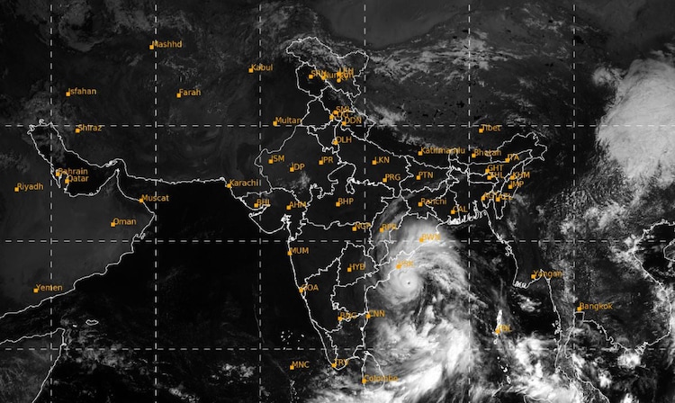
WHEN WILL CYCLONE ARNAB MAKE LANDFALL?
According to the IMD's latest bulletin issued on October 27, Arnab was centred over the west-central Bay of Bengal at 8:30 am, about 220 km south-southeast of Visakhapatnam.
The storm is expected to move northwest after Tuesday evening and cross the Andhra Pradesh and Yanam coasts between Bapatla and Visakhapatnam, close to Yanam, by Wednesday forenoon.
Yanam is a coastal enclave of Puducherry located in Andhra Pradesh.
Coastal districts from Krishna to Anakapalli could experience winds of 115-125 kmph, gusting to 140 kmph, from early morning until forenoon on Wednesday. Wind speeds are expected to ease to 60-70 kmph by evening.
The IMD has also warned of a storm surge, which is an abnormal rise in sea level caused by a cyclone, of 1-1.5 metres above the normal tide.
Low-lying coastal areas could face flooding, with the highest surge expected near Kakinada in East Godavari district and in Yanam.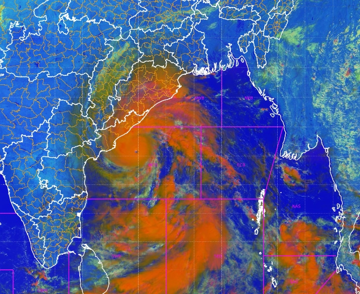
EXTREMELY HEAVY RAIN LIKELY
On Wednesday, heavy to very heavy rainfall, with extremely heavy showers at isolated places, is likely over coastal Andhra Pradesh, Odisha and Chhattisgarh. Telangana and Vidarbha may also receive heavy to very heavy rain.
Heavy rainfall is forecast at isolated places in East Madhya Pradesh, Jharkhand, Gangetic West Bengal, Assam, Meghalaya, the Andaman and Nicobar Islands, and Nagaland, Manipur, Mizoram and Tripura.
The IMD has flagged a moderate flash flood risk in parts of Andhra Pradesh, Odisha and Chhattisgarh until 11:30 pm on Wednesday.
Flash floods can develop rapidly when intense rainfall overwhelms drainage systems and local waterways.
THUNDERSTORMS AND GUSTY WINDS ELSEWHERE
Thunderstorms accompanied by strong, sudden gusts of 60-70 kmph, reaching 80 kmph, are likely over Odisha and Chhattisgarh. Jharkhand and Telangana may experience gusts of 50-60 kmph.
Isolated thunderstorms with lightning and gusty winds of 40-50 kmph are forecast over Bihar, East Madhya Pradesh, Gangetic West Bengal, Haryana, Chandigarh, Delhi, Maharashtra and the Andaman and Nicobar Islands.
East Uttar Pradesh, interior Karnataka, Kerala and Rayalaseema may experience gusty winds of 30-40 kmph.