Monsoon fury: Extremely heavy rain to lash these states on Sunday
The IMD has warned of extremely heavy rainfall over Gujarat, Odisha, Konkan and Maharashtra on July 5 as a well-marked low-pressure area moves inland from the Bay of Bengal. Delhi is set for light rain, thunderstorms and below-normal temperatures.
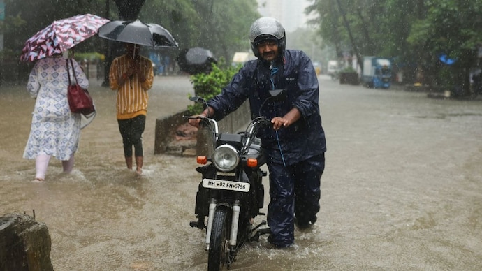
The southwest monsoon is set to deliver one of its fiercest spells of the 2026 season on Sunday, July 5, with the India Meteorological Department (IMD) warning of extremely heavy rainfall over Saurashtra and Kutch, Odisha, Konkan and Goa, the Gujarat region and Madhya Maharashtra.
The trigger is a well-marked low-pressure area over the northwest Bay of Bengal, which is very likely to travel inland across north Odisha and north Chhattisgarh over the next three days.
The scale of the downpour is already staggering. Mangrol in Gujarat's Junagadh district recorded 57 cm of rain in the 24 hours ending on the morning of Saturday, July 4, an amount the IMD classifies as exceptionally heavy.
WHY IS INDIA RECEIVING SO MUCH RAIN RIGHT NOW?
A low-pressure area is a patch of the atmosphere where air pressure is lower than in surrounding regions. Moist air from the sea rushes towards it, rises, cools and condenses into towering rain clouds. When such a system intensifies and its centre becomes clearly defined, meteorologists call it well-marked.
This system is not working alone. The monsoon trough, an elongated belt of low pressure stretching across the country, is active and lying south of its usual position, a setup that favours heavy rain over central India.
An offshore trough, a similar low-pressure channel hugging the west coast from south Gujarat to Karnataka, is drawing moisture from the Arabian Sea.
In effect, two moisture streams are feeding the same rain belt. Research has shown that Bay of Bengal low-pressure systems can strongly influence rainfall over western India through such large-scale connections.
WHICH STATES ARE ON ALERT FOR HEAVY RAIN ON JULY 5?
The IMD expects extremely heavy rainfall, meaning more than 204.4 mm in 24 hours, in isolated places throughout Saurashtra and Kutch, Odisha, Konkan and Goa, the Gujarat region and Madhya Maharashtra.
Very heavy rain is likely in isolated places throughout West Madhya Pradesh, East Madhya Pradesh, Chhattisgarh, Vidarbha, East Rajasthan, Uttarakhand, Gangetic West Bengal, Telangana and coastal Karnataka.
The department has flagged urban flooding, waterlogging, traffic disruption and localised landslides in hilly terrain.
Fishermen have been told to stay out of large parts of the Arabian Sea and the Bay of Bengal.
WILL IT RAIN IN DELHI ON JULY 5?
Yes, though gently. Delhi can expect a generally cloudy sky and a spell of very light to light rain with thunderstorms, lightning and gusty winds of 30 to 40 kmph, gusting to 50 kmph, towards the morning.
The maximum temperature will hover between 32 and 34 degrees Celsius, below normal, while the minimum stays between 27 and 29 degrees Celsius.
WHERE HAS THE MONSOON REACHED?
The northern limit of the monsoon now passes through Jamnagar, Udaipur, Ajmer, Jhunjhunu, Hisar and Bhatinda.
Conditions favour its advance into more of Gujarat, Rajasthan and the remaining parts of Haryana and Punjab within four days.