Brace for rain: Monsoon roars back on Monday, flash floods likely in North India
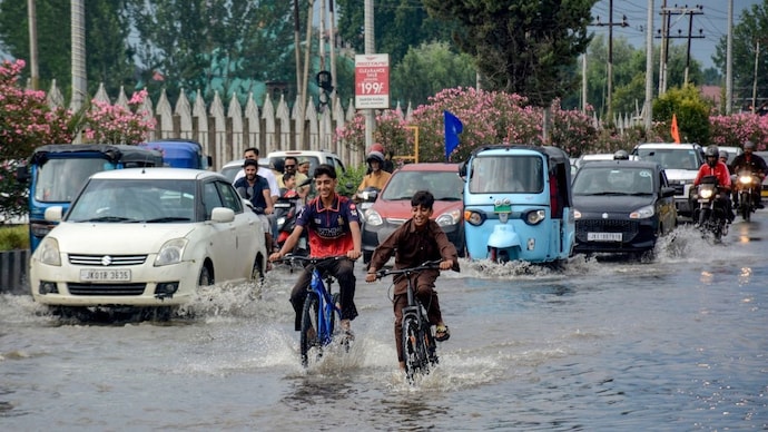
The India Meteorological Department has forecast heavy to extremely heavy rainfall across North and Northeast India on Monday, July 20, with a flash flood alert issued for Uttarakhand and parts of Assam and Meghalaya.
Somewhere over the Himalayas, the sky is about to open up.
After a fortnight in which the monsoon seemed to be catching its breath, the India Meteorological Department's latest bulletin, issued on July 19, says the system is roaring back to life, and Monday is when the country feels it first.
WHY IS RAINFALL SUDDENLY INCREASING ACROSS NORTH INDIA?
The answer lies in a feature called the monsoon trough, an elongated belt of low pressure that runs across the country and effectively acts as the monsoon's spine, steering where rain-bearing clouds travel. Its western end currently sits north of its usual position.
Layered on top of that are several upper air cyclonic circulations, pockets of swirling wind a few kilometres above the ground that pull in moisture and organise it into rain.
IMD has mapped these over north Punjab, north Jharkhand and Bihar, southwest Madhya Pradesh, coastal Andhra Pradesh and Assam.
A trough also connects north Bihar to the northwest Bay of Bengal. Together, these systems are dragging moisture in from both the Arabian Sea and the Bay of Bengal at once, which is why rain is picking up almost everywhere at the same time.
WHICH STATES ARE UNDER ALERT ON MONDAY, JULY 20?
Uttarakhand is expected to see heavy to very heavy rain, with extremely heavy falls, classified by IMD as anything above 204.4 mm in a day, possible in isolated pockets.
Jammu and Kashmir and Himachal Pradesh face similar warnings into the following two days.
Sub-Himalayan West Bengal, Sikkim and Meghalaya, among India's wettest regions, remain active as well.
Meghalaya's Sohra recorded 27 cm of rain in the 24 hours before the bulletin was issued, among the heaviest anywhere in the country this week.
WHAT WILL DELHI'S WEATHER BE LIKE ON MONDAY?
The capital gets a cloudy, showery day: light rain at many places, moderate spells in a few areas, thunderstorms, and winds gusting to 40 kmph in the morning and again at night.
The maximum temperature is forecast at 32 to 34 degrees Celsius, roughly three to five degrees below normal, a welcome dip after recent heat.
IS THERE A FLASH FLOOD RISK ON MONDAY?
Yes. IMD's flash flood guidance flags low to moderate risk until 11:30 pm IST on Monday across several Uttarakhand districts, including Dehradun, Chamoli and Uttarkashi, and parts of Assam and Meghalaya such as Cachar and the Khasi Hills.
Saturated soils mean even routine showers there could cause runoff and localised flooding. Peninsular India, by contrast, stays largely dry, with the weather office describing conditions there as subdued for the coming week.
Somewhere over the Himalayas, the sky is about to open up.
After a fortnight in which the monsoon seemed to be catching its breath, the India Meteorological Department's latest bulletin, issued on July 19, says the system is roaring back to life, and Monday is when the country feels it first.
WHY IS RAINFALL SUDDENLY INCREASING ACROSS NORTH INDIA?
The answer lies in a feature called the monsoon trough, an elongated belt of low pressure that runs across the country and effectively acts as the monsoon's spine, steering where rain-bearing clouds travel. Its western end currently sits north of its usual position.
Layered on top of that are several upper air cyclonic circulations, pockets of swirling wind a few kilometres above the ground that pull in moisture and organise it into rain.
IMD has mapped these over north Punjab, north Jharkhand and Bihar, southwest Madhya Pradesh, coastal Andhra Pradesh and Assam.
A trough also connects north Bihar to the northwest Bay of Bengal. Together, these systems are dragging moisture in from both the Arabian Sea and the Bay of Bengal at once, which is why rain is picking up almost everywhere at the same time.
WHICH STATES ARE UNDER ALERT ON MONDAY, JULY 20?
Uttarakhand is expected to see heavy to very heavy rain, with extremely heavy falls, classified by IMD as anything above 204.4 mm in a day, possible in isolated pockets.
Jammu and Kashmir and Himachal Pradesh face similar warnings into the following two days.
Sub-Himalayan West Bengal, Sikkim and Meghalaya, among India's wettest regions, remain active as well.
Meghalaya's Sohra recorded 27 cm of rain in the 24 hours before the bulletin was issued, among the heaviest anywhere in the country this week.
WHAT WILL DELHI'S WEATHER BE LIKE ON MONDAY?
The capital gets a cloudy, showery day: light rain at many places, moderate spells in a few areas, thunderstorms, and winds gusting to 40 kmph in the morning and again at night.
The maximum temperature is forecast at 32 to 34 degrees Celsius, roughly three to five degrees below normal, a welcome dip after recent heat.
IS THERE A FLASH FLOOD RISK ON MONDAY?
Yes. IMD's flash flood guidance flags low to moderate risk until 11:30 pm IST on Monday across several Uttarakhand districts, including Dehradun, Chamoli and Uttarkashi, and parts of Assam and Meghalaya such as Cachar and the Khasi Hills.
Saturated soils mean even routine showers there could cause runoff and localised flooding. Peninsular India, by contrast, stays largely dry, with the weather office describing conditions there as subdued for the coming week.
Somewhere over the Himalayas, the sky is about to open up.
After a fortnight in which the monsoon seemed to be catching its breath, the India Meteorological Department's latest bulletin, issued on July 19, says the system is roaring back to life, and Monday is when the country feels it first.
WHY IS RAINFALL SUDDENLY INCREASING ACROSS NORTH INDIA?
The answer lies in a feature called the monsoon trough, an elongated belt of low pressure that runs across the country and effectively acts as the monsoon's spine, steering where rain-bearing clouds travel. Its western end currently sits north of its usual position.
Layered on top of that are several upper air cyclonic circulations, pockets of swirling wind a few kilometres above the ground that pull in moisture and organise it into rain.
IMD has mapped these over north Punjab, north Jharkhand and Bihar, southwest Madhya Pradesh, coastal Andhra Pradesh and Assam.
A trough also connects north Bihar to the northwest Bay of Bengal. Together, these systems are dragging moisture in from both the Arabian Sea and the Bay of Bengal at once, which is why rain is picking up almost everywhere at the same time.
WHICH STATES ARE UNDER ALERT ON MONDAY, JULY 20?
Uttarakhand is expected to see heavy to very heavy rain, with extremely heavy falls, classified by IMD as anything above 204.4 mm in a day, possible in isolated pockets.
Jammu and Kashmir and Himachal Pradesh face similar warnings into the following two days.
Sub-Himalayan West Bengal, Sikkim and Meghalaya, among India's wettest regions, remain active as well.
Meghalaya's Sohra recorded 27 cm of rain in the 24 hours before the bulletin was issued, among the heaviest anywhere in the country this week.
WHAT WILL DELHI'S WEATHER BE LIKE ON MONDAY?
The capital gets a cloudy, showery day: light rain at many places, moderate spells in a few areas, thunderstorms, and winds gusting to 40 kmph in the morning and again at night.
The maximum temperature is forecast at 32 to 34 degrees Celsius, roughly three to five degrees below normal, a welcome dip after recent heat.
IS THERE A FLASH FLOOD RISK ON MONDAY?
Yes. IMD's flash flood guidance flags low to moderate risk until 11:30 pm IST on Monday across several Uttarakhand districts, including Dehradun, Chamoli and Uttarkashi, and parts of Assam and Meghalaya such as Cachar and the Khasi Hills.
Saturated soils mean even routine showers there could cause runoff and localised flooding. Peninsular India, by contrast, stays largely dry, with the weather office describing conditions there as subdued for the coming week.

