North India's monsoon returns: Relief from heat and humidity now, flood risk later
North India's monsoon trough is finally shifting back to the plains after weeks of hot, humid weather, bringing rain relief to Delhi NCR, Punjab, Haryana, Uttar Pradesh and Rajasthan from July 20.
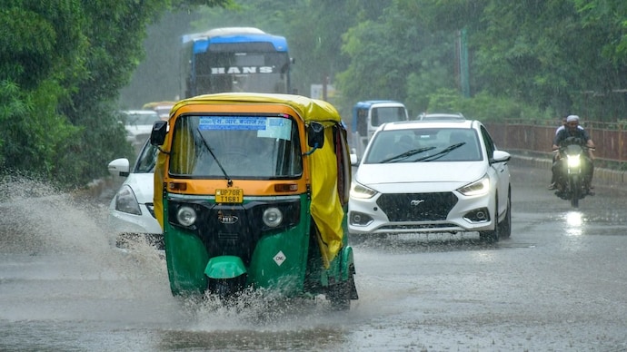
North India's monsoon, missing for most of July, is finally making its way back onto the plains.
For weeks, Delhi NCR, Punjab, Haryana, Uttar Pradesh and Rajasthan have been stuck in what meteorologists call a break monsoon phase.
WHY DID THE RAIN VANISH FROM THE PLAINS?
This happens when the monsoon trough, an elongated belt of low pressure that acts as the backbone of the rains, drifts north and settles against the Himalayan foothills instead of sitting over the plains, so the hills get soaked while rainfall over the plains drops sharply.
India's seasonal rainfall deficit has reached around 24 per cent, with the country receiving 244.6 mm of rain against a normal of 323.1 mm, while high humidity and strong sunshine pushed heat index values past 40 degrees Celsius in several cities.
WHAT IS BRINGING THE RAIN BACK?
A fresh low pressure area is forming over the Bay of Bengal, a patch of atmosphere where rising air acts like a giant vacuum, pulling in moist winds from the sea and organising them into rain-bearing clouds.
As the system drifts inland towards central India, it is expected to drag the monsoon trough back south, allowing moist winds from the Bay of Bengal and the Arabian Sea to push deep into the plains.
WHEN WILL DELHI NCR FEEL THE CHANGE?
The IMD has forecast a sharp intensification of rain activity between July 20 and 22, with widespread showers and isolated heavy rain expected to pull Delhi's daytime temperature down from around 40 degrees towards 30 degrees Celsius by Tuesday.
The rain belt is expected to widen further across Madhya Pradesh, Uttar Pradesh, Delhi and east Rajasthan between July 25 and 28.
WHY ARE THE HIMALAYAS AT HIGHER RISK?
When moisture-laden winds strike steep mountain slopes, they are forced upward rapidly, a process called orographic lift, which cools the air fast and squeezes out intense, localised rain.
The IMD has flagged extremely heavy rainfall at isolated places in Jammu and Kashmir between July 20 and 22, and over Himachal Pradesh and Uttarakhand on July 20. With soil already saturated from earlier spells, this raises the risk of cloudbursts, flash floods and landslides across the western Himalayas.
WILL THIS END INDIA'S RAINFALL DEFICIT?
Not entirely, but it should help. Forecasters expect the widening rain belt and rising intensity to arrest India's growing rainfall deficit after July 20, with a gradual recovery possible between July 24 and 28, and the shortfall potentially easing to around 10 per cent by the end of the month.
For north India's residents, the message is simple: the sticky, oppressive stretch of July is ending, but the rain's return will bring its own hazards, especially in the hills.
North India's monsoon, missing for most of July, is finally making its way back onto the plains.
For weeks, Delhi NCR, Punjab, Haryana, Uttar Pradesh and Rajasthan have been stuck in what meteorologists call a break monsoon phase.
WHY DID THE RAIN VANISH FROM THE PLAINS?
This happens when the monsoon trough, an elongated belt of low pressure that acts as the backbone of the rains, drifts north and settles against the Himalayan foothills instead of sitting over the plains, so the hills get soaked while rainfall over the plains drops sharply.
India's seasonal rainfall deficit has reached around 24 per cent, with the country receiving 244.6 mm of rain against a normal of 323.1 mm, while high humidity and strong sunshine pushed heat index values past 40 degrees Celsius in several cities.
WHAT IS BRINGING THE RAIN BACK?
A fresh low pressure area is forming over the Bay of Bengal, a patch of atmosphere where rising air acts like a giant vacuum, pulling in moist winds from the sea and organising them into rain-bearing clouds.
As the system drifts inland towards central India, it is expected to drag the monsoon trough back south, allowing moist winds from the Bay of Bengal and the Arabian Sea to push deep into the plains.
WHEN WILL DELHI NCR FEEL THE CHANGE?
The IMD has forecast a sharp intensification of rain activity between July 20 and 22, with widespread showers and isolated heavy rain expected to pull Delhi's daytime temperature down from around 40 degrees towards 30 degrees Celsius by Tuesday.
The rain belt is expected to widen further across Madhya Pradesh, Uttar Pradesh, Delhi and east Rajasthan between July 25 and 28.
WHY ARE THE HIMALAYAS AT HIGHER RISK?
When moisture-laden winds strike steep mountain slopes, they are forced upward rapidly, a process called orographic lift, which cools the air fast and squeezes out intense, localised rain.
The IMD has flagged extremely heavy rainfall at isolated places in Jammu and Kashmir between July 20 and 22, and over Himachal Pradesh and Uttarakhand on July 20. With soil already saturated from earlier spells, this raises the risk of cloudbursts, flash floods and landslides across the western Himalayas.
WILL THIS END INDIA'S RAINFALL DEFICIT?
Not entirely, but it should help. Forecasters expect the widening rain belt and rising intensity to arrest India's growing rainfall deficit after July 20, with a gradual recovery possible between July 24 and 28, and the shortfall potentially easing to around 10 per cent by the end of the month.
For north India's residents, the message is simple: the sticky, oppressive stretch of July is ending, but the rain's return will bring its own hazards, especially in the hills.
North India's monsoon, missing for most of July, is finally making its way back onto the plains.
For weeks, Delhi NCR, Punjab, Haryana, Uttar Pradesh and Rajasthan have been stuck in what meteorologists call a break monsoon phase.
WHY DID THE RAIN VANISH FROM THE PLAINS?
This happens when the monsoon trough, an elongated belt of low pressure that acts as the backbone of the rains, drifts north and settles against the Himalayan foothills instead of sitting over the plains, so the hills get soaked while rainfall over the plains drops sharply.
India's seasonal rainfall deficit has reached around 24 per cent, with the country receiving 244.6 mm of rain against a normal of 323.1 mm, while high humidity and strong sunshine pushed heat index values past 40 degrees Celsius in several cities.
WHAT IS BRINGING THE RAIN BACK?
A fresh low pressure area is forming over the Bay of Bengal, a patch of atmosphere where rising air acts like a giant vacuum, pulling in moist winds from the sea and organising them into rain-bearing clouds.
As the system drifts inland towards central India, it is expected to drag the monsoon trough back south, allowing moist winds from the Bay of Bengal and the Arabian Sea to push deep into the plains.
WHEN WILL DELHI NCR FEEL THE CHANGE?
The IMD has forecast a sharp intensification of rain activity between July 20 and 22, with widespread showers and isolated heavy rain expected to pull Delhi's daytime temperature down from around 40 degrees towards 30 degrees Celsius by Tuesday.
The rain belt is expected to widen further across Madhya Pradesh, Uttar Pradesh, Delhi and east Rajasthan between July 25 and 28.
WHY ARE THE HIMALAYAS AT HIGHER RISK?
When moisture-laden winds strike steep mountain slopes, they are forced upward rapidly, a process called orographic lift, which cools the air fast and squeezes out intense, localised rain.
The IMD has flagged extremely heavy rainfall at isolated places in Jammu and Kashmir between July 20 and 22, and over Himachal Pradesh and Uttarakhand on July 20. With soil already saturated from earlier spells, this raises the risk of cloudbursts, flash floods and landslides across the western Himalayas.
WILL THIS END INDIA'S RAINFALL DEFICIT?
Not entirely, but it should help. Forecasters expect the widening rain belt and rising intensity to arrest India's growing rainfall deficit after July 20, with a gradual recovery possible between July 24 and 28, and the shortfall potentially easing to around 10 per cent by the end of the month.
For north India's residents, the message is simple: the sticky, oppressive stretch of July is ending, but the rain's return will bring its own hazards, especially in the hills.

