
Heavy rain to hit South India on Sunday, Bay system to pick up pace

Heavy rain, thunderstorms and gusty winds are forecast in parts of South India as a Bay of Bengal system moves towards the eastern coast. Here's what the weather has in store for Sunday.

 Last UpdatedOct 24, 2026 19:30 IST
 Published by
Heavy to extremely heavy rainfall is likely in parts of south India on Sunday, October 25, as a weather system over the Bay of Bengal is expected to intensify further, according to the India Meteorological Department (IMD).
Kerala, Tamil Nadu, Puducherry and Karaikal are likely to receive intense rainfall at isolated places, while parts of Karnataka, Lakshadweep and the Andaman and Nicobar Islands may also experience heavy showers.
The developing system over the Bay of Bengal is expected to become a deep depression on October 25 before strengthening into a cyclonic storm by the morning of October 26.
HEAVY RAIN TO HIT SOUTH INDIA
The IMD has forecast heavy to very heavy rainfall, with extremely heavy showers possible at isolated places, over Kerala and Mahe, Tamil Nadu, Puducherry and Karaikal on October 25.
Southern Karnataka is also likely to receive heavy rainfall at isolated places, while heavy showers are expected over Lakshadweep and the Andaman and Nicobar Islands.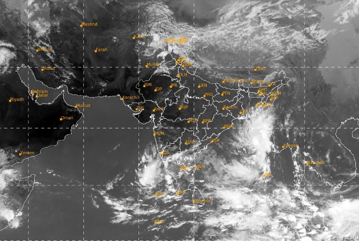
Thunderstorms accompanied by lightning and gusty winds are likely in parts of Tamil Nadu, Puducherry and Karaikal, with wind speeds reaching 40-50 kmph at isolated places. Gusty winds of 30-40 kmph are also likely in parts of Andhra Pradesh, Kerala and Lakshadweep.
The IMD has also flagged a low to moderate risk of flash floods in some watersheds and neighbourhoods of Kerala and Tamil Nadu over the next 24 hours.
These risks arise when intense rainfall overwhelms the ground's ability to absorb water, potentially causing rapid runoff and localised inundation.
A CYCLONE IS COMING
The main weather development is a well-marked low-pressure area over the east-central and adjoining southeast Bay of Bengal. A low-pressure area is a region where atmospheric pressure is lower than its surroundings, often helping clouds and rain-bearing systems develop.
The IMD said the system was likely to intensify into a depression on Saturday, move west-northwestwards and strengthen into a deep depression on Sunday. It is then expected to become a cyclonic storm over the west-central Bay of Bengal by the morning of October 26.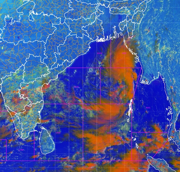
The system is forecast to move closer to the Andhra Pradesh coast around the morning of October 28, potentially bringing heavy rainfall and strong winds to parts of the eastern coast in the coming days.
The IMD has forecast squally winds of 50-60 kmph, gusting to 70 kmph, over parts of the Bay of Bengal on October 25. Winds over the sea are expected to strengthen further as the system intensifies.
The evolving system will remain the key weather development to watch as rainfall activity expands towards the eastern coast later in the week.