Monsoon rain to stay active over these states as baking heat returns to India Monday
On Monday, the monsoon will drench the Himalayas and the northeast while some states bake under heat and humidity. Weak El Nino conditions and a shifted monsoon trough explain why one season is producing floods, drought and heat, all at once.
Cyclonic circulation over Uttar Pradesh, a stalled Bay of Bengal, and a heatwave sitting stubbornly over the southeast coast. Here is what India's weather will look like on Monday, July 13, 2026.
Ask 10 people what the monsoon will do on Monday and you will get 10 different answers, and every single one of them will be correct.
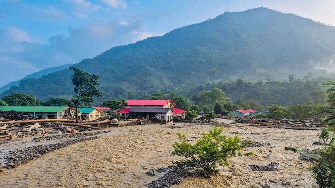
In the hills of Uttarakhand and Himachal Pradesh, rivers will swell and roads will wash out. In Assam and Meghalaya, the rain will barely pause.
In Delhi, the sky will do very little except sit there, humid and unhelpful.
In large stretches of central India, farmers will watch clouds pass overhead without dropping a drop. And on the southeast coast, people will be dealing with something that should not exist in the middle of monsoon season at all: heat.
The India Meteorological Department (IMD) says the monsoon covered the whole country by July 9, a day later than usual. But covering the country and watering it evenly are two very different things, and Monday will make that clear.
WHY WILL THE RAIN BE SO LOPSIDED ON MONDAY?
The monsoon trough, an elongated belt of low pressure that acts as the rain's steering line, will run from Sri Ganganagar in Rajasthan through Hisar, Meerut, Gorakhpur and Muzaffarpur, and on towards Assam. Almost everything the trough touches will get rain. Almost everything south of it will not.
That is why Uttarakhand, Himachal Pradesh, Bihar, sub-Himalayan West Bengal and the northeast will see heavy to very heavy rain on Monday, while Maharashtra, Madhya Pradesh, Gujarat and Chhattisgarh will have a comparatively dry day.
WHY WILL CENTRAL INDIA MISS OUT ON THE RAIN?
Central India usually gets its heaviest July rain from low-pressure systems that form over the Bay of Bengal and travel westwards, dragging moisture with them. No such system is in place for Monday.
Without it, clouds will have less fuel to build into proper rain-bearing systems, so showers will stay patchy and localised instead of widespread.
WHICH STATES WILL SEE HEATWAVE CONDITIONS ON MONDAY?
Coastal Andhra Pradesh will remain under an official heatwave, an unusual state of affairs for the middle of the monsoon. Odisha will not be far behind, with hot and distinctly humid weather that will feel similar even without a formal heatwave alert. Coastal Tamil Nadu will see the same pattern.
The reason is simple: with the monsoon trough pulled north towards the Himalayas, these coastal stretches will be left with thin cloud cover, so the sun will heat the surface with little to interrupt it, and the moisture in the air will stop that heat from escaping easily.
WHY WILL DELHI FEEL HOTTER THAN WHAT THE THERMOMETER SAYS?
Delhi's maximum temperature on Monday is expected to sit around 36 to 38 degrees Celsius, not unusual for July. But the air will be holding more moisture than usual for a monsoon month.
Humid air slows down how quickly sweat evaporates off your skin, which is the body's main cooling method, so Monday will feel noticeably more oppressive than a dry 36 degrees would.
WHAT WILL EL NINO DO TO INDIA'S MONSOON THIS WEEK?
A weak El Nino, a periodic warming of the central and eastern Pacific Ocean that is known to weaken the Indian monsoon, will keep strengthening through July.
The Indian Ocean Dipole, a similar temperature pattern in the Indian Ocean that can offset El Nino's effect, will stay neutral, offering no cushion.
Together, they are why the IMD expects the month's overall rainfall to land below the long-period average.
None of this will mean the monsoon has failed. It will simply behave exactly as unevenly as the physics predicts on Monday, generous in the hills, punishing on the coast, and testing everyone's patience in between.
Cyclonic circulation over Uttar Pradesh, a stalled Bay of Bengal, and a heatwave sitting stubbornly over the southeast coast. Here is what India's weather will look like on Monday, July 13, 2026.
Ask 10 people what the monsoon will do on Monday and you will get 10 different answers, and every single one of them will be correct.
In the hills of Uttarakhand and Himachal Pradesh, rivers will swell and roads will wash out. In Assam and Meghalaya, the rain will barely pause.
In Delhi, the sky will do very little except sit there, humid and unhelpful.
In large stretches of central India, farmers will watch clouds pass overhead without dropping a drop. And on the southeast coast, people will be dealing with something that should not exist in the middle of monsoon season at all: heat.
The India Meteorological Department (IMD) says the monsoon covered the whole country by July 9, a day later than usual. But covering the country and watering it evenly are two very different things, and Monday will make that clear.
WHY WILL THE RAIN BE SO LOPSIDED ON MONDAY?
The monsoon trough, an elongated belt of low pressure that acts as the rain's steering line, will run from Sri Ganganagar in Rajasthan through Hisar, Meerut, Gorakhpur and Muzaffarpur, and on towards Assam. Almost everything the trough touches will get rain. Almost everything south of it will not.
That is why Uttarakhand, Himachal Pradesh, Bihar, sub-Himalayan West Bengal and the northeast will see heavy to very heavy rain on Monday, while Maharashtra, Madhya Pradesh, Gujarat and Chhattisgarh will have a comparatively dry day.
WHY WILL CENTRAL INDIA MISS OUT ON THE RAIN?
Central India usually gets its heaviest July rain from low-pressure systems that form over the Bay of Bengal and travel westwards, dragging moisture with them. No such system is in place for Monday.
Without it, clouds will have less fuel to build into proper rain-bearing systems, so showers will stay patchy and localised instead of widespread.
WHICH STATES WILL SEE HEATWAVE CONDITIONS ON MONDAY?
Coastal Andhra Pradesh will remain under an official heatwave, an unusual state of affairs for the middle of the monsoon. Odisha will not be far behind, with hot and distinctly humid weather that will feel similar even without a formal heatwave alert. Coastal Tamil Nadu will see the same pattern.
The reason is simple: with the monsoon trough pulled north towards the Himalayas, these coastal stretches will be left with thin cloud cover, so the sun will heat the surface with little to interrupt it, and the moisture in the air will stop that heat from escaping easily.
WHY WILL DELHI FEEL HOTTER THAN WHAT THE THERMOMETER SAYS?
Delhi's maximum temperature on Monday is expected to sit around 36 to 38 degrees Celsius, not unusual for July. But the air will be holding more moisture than usual for a monsoon month.
Humid air slows down how quickly sweat evaporates off your skin, which is the body's main cooling method, so Monday will feel noticeably more oppressive than a dry 36 degrees would.
WHAT WILL EL NINO DO TO INDIA'S MONSOON THIS WEEK?
A weak El Nino, a periodic warming of the central and eastern Pacific Ocean that is known to weaken the Indian monsoon, will keep strengthening through July.
The Indian Ocean Dipole, a similar temperature pattern in the Indian Ocean that can offset El Nino's effect, will stay neutral, offering no cushion.
Together, they are why the IMD expects the month's overall rainfall to land below the long-period average.
None of this will mean the monsoon has failed. It will simply behave exactly as unevenly as the physics predicts on Monday, generous in the hills, punishing on the coast, and testing everyone's patience in between.

