Monsoon at high risk: Will a strengthening El Nino finish India's rainy season?
June began with one of the worst monsoon deficits in over a century before July attempted a brave recovery. But a fresh global climate warning now raises questions over whether that turnaround can last or will the monsoon run dry.
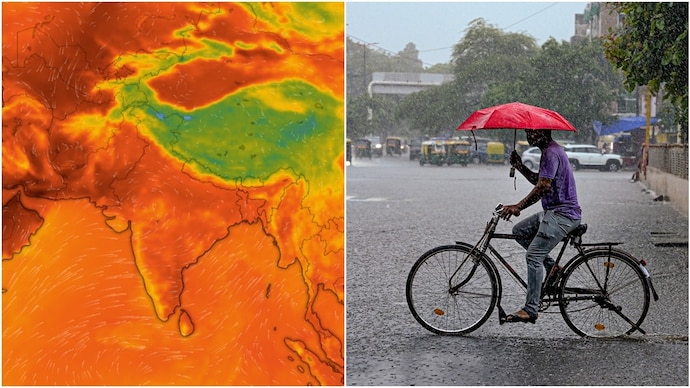
India's southwest monsoon, which has already swung between a severe rainfall deficit and bouts of heavy rain this season, could face fresh disruption after the United Nations (UN)'s weather agency warned that El Nino is likely to intensify into a strong event over the next few months.
The warning from the World Meteorological Organisation (WMO) came as the India Meteorological Department (IMD) has already forecast below-normal rainfall during August, raising concerns that the second half of the monsoon could be weaker than usual.
According to the WMO, the Super El Nino is expected to strengthen during the August-October 2026 period.
Along with exceptionally warm oceans and a likely positive Indian Ocean Dipole (IOD), it is expected to bring above-normal temperatures across much of the world while significantly altering rainfall patterns.
While some regions are likely to receive excess rainfall, others could face an increased risk of drought.
AN ERRATIC INDIAN MONSOON
India's monsoon has had an uneven journey this year. June ended with a 39.8% rainfall deficit, making it one of the driest Junes in more than a century after the monsoon's advance stalled for weeks across large parts of the country.
Rainfall picked up sharply in July as several low-pressure systems became active, bringing widespread showers to many parts of central, western and north India.
However, the recovery has been uneven, with some regions receiving excess rainfall while others continue to record deficits.
Despite July's improvement, the IMD has forecast that rainfall during August is likely to remain below normal, at around 94% of the Long Period Average (LPA).
The weather agency has also said El Nino is expected to strengthen into a moderate event during the latter half of the monsoon season, increasing the uncertainty around rainfall distribution.
EL NINO TO WREAK HAVOC
El Nino is a naturally occurring climate phenomenon caused by warmer-than-normal sea surface temperatures in the central and eastern Pacific Ocean.
Although it develops thousands of kilometres away from India, it influences weather patterns across the globe and has historically been associated with weaker Indian monsoons.
The WMO said forecasts indicate sea surface temperature anomalies in key monitoring regions could exceed 2.9°C during August-October, signalling a strong El Nino.
UN Secretary-General Antonio Guterres warned that the climate event is adding fuel to a planet already battered by extreme heat, wildfires and record-breaking ocean temperatures.
El Nino, as Guterres put it, has "entered our home."
India's southwest monsoon, which has already swung between a severe rainfall deficit and bouts of heavy rain this season, could face fresh disruption after the United Nations (UN)'s weather agency warned that El Nino is likely to intensify into a strong event over the next few months.
The warning from the World Meteorological Organisation (WMO) came as the India Meteorological Department (IMD) has already forecast below-normal rainfall during August, raising concerns that the second half of the monsoon could be weaker than usual.
According to the WMO, the Super El Nino is expected to strengthen during the August-October 2026 period.
Along with exceptionally warm oceans and a likely positive Indian Ocean Dipole (IOD), it is expected to bring above-normal temperatures across much of the world while significantly altering rainfall patterns.
While some regions are likely to receive excess rainfall, others could face an increased risk of drought.
AN ERRATIC INDIAN MONSOON
India's monsoon has had an uneven journey this year. June ended with a 39.8% rainfall deficit, making it one of the driest Junes in more than a century after the monsoon's advance stalled for weeks across large parts of the country.
Rainfall picked up sharply in July as several low-pressure systems became active, bringing widespread showers to many parts of central, western and north India.
However, the recovery has been uneven, with some regions receiving excess rainfall while others continue to record deficits.
Despite July's improvement, the IMD has forecast that rainfall during August is likely to remain below normal, at around 94% of the Long Period Average (LPA).
The weather agency has also said El Nino is expected to strengthen into a moderate event during the latter half of the monsoon season, increasing the uncertainty around rainfall distribution.
EL NINO TO WREAK HAVOC
El Nino is a naturally occurring climate phenomenon caused by warmer-than-normal sea surface temperatures in the central and eastern Pacific Ocean.
Although it develops thousands of kilometres away from India, it influences weather patterns across the globe and has historically been associated with weaker Indian monsoons.
The WMO said forecasts indicate sea surface temperature anomalies in key monitoring regions could exceed 2.9°C during August-October, signalling a strong El Nino.
UN Secretary-General Antonio Guterres warned that the climate event is adding fuel to a planet already battered by extreme heat, wildfires and record-breaking ocean temperatures.
El Nino, as Guterres put it, has "entered our home."
India's southwest monsoon, which has already swung between a severe rainfall deficit and bouts of heavy rain this season, could face fresh disruption after the United Nations (UN)'s weather agency warned that El Nino is likely to intensify into a strong event over the next few months.
The warning from the World Meteorological Organisation (WMO) came as the India Meteorological Department (IMD) has already forecast below-normal rainfall during August, raising concerns that the second half of the monsoon could be weaker than usual.
According to the WMO, the Super El Nino is expected to strengthen during the August-October 2026 period.
Along with exceptionally warm oceans and a likely positive Indian Ocean Dipole (IOD), it is expected to bring above-normal temperatures across much of the world while significantly altering rainfall patterns.
While some regions are likely to receive excess rainfall, others could face an increased risk of drought.
AN ERRATIC INDIAN MONSOON
India's monsoon has had an uneven journey this year. June ended with a 39.8% rainfall deficit, making it one of the driest Junes in more than a century after the monsoon's advance stalled for weeks across large parts of the country.
Rainfall picked up sharply in July as several low-pressure systems became active, bringing widespread showers to many parts of central, western and north India.
However, the recovery has been uneven, with some regions receiving excess rainfall while others continue to record deficits.
Despite July's improvement, the IMD has forecast that rainfall during August is likely to remain below normal, at around 94% of the Long Period Average (LPA).
The weather agency has also said El Nino is expected to strengthen into a moderate event during the latter half of the monsoon season, increasing the uncertainty around rainfall distribution.
EL NINO TO WREAK HAVOC
El Nino is a naturally occurring climate phenomenon caused by warmer-than-normal sea surface temperatures in the central and eastern Pacific Ocean.
Although it develops thousands of kilometres away from India, it influences weather patterns across the globe and has historically been associated with weaker Indian monsoons.
The WMO said forecasts indicate sea surface temperature anomalies in key monitoring regions could exceed 2.9°C during August-October, signalling a strong El Nino.
UN Secretary-General Antonio Guterres warned that the climate event is adding fuel to a planet already battered by extreme heat, wildfires and record-breaking ocean temperatures.
El Nino, as Guterres put it, has "entered our home."

